
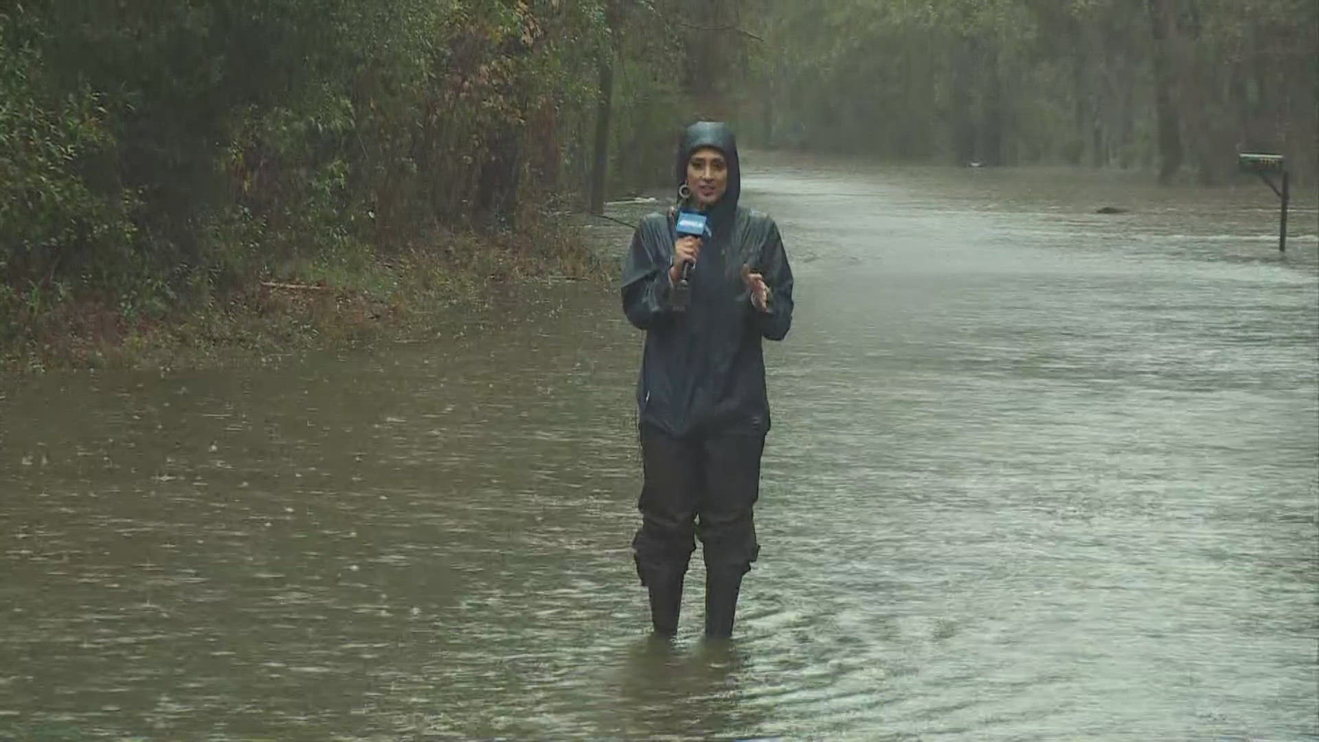
NEW ORLEANS — After an evening of Flash Flood Warnings and torrential rainfall sweeping across southeast Louisiana and over the Mississippi Coast, New Orleans and the surrounding area, including the River Parishes and Northshore, was once again deluged with rain on Thursday morning.
Stay tuned to WWL Louisiana and logged on to wwltv.com for further updates like the info below:
7:15 PM: Reminder that a Dense Fog Advisory was issued for portions of the coastal parishes in southeastern Louisiana from Terrebonne Parish through St. Tammany Parish, as well as Hancock, Harrison, and Jackson counties in coastal Mississippi.
The advisory is from midnight to 9 a.m. Friday.
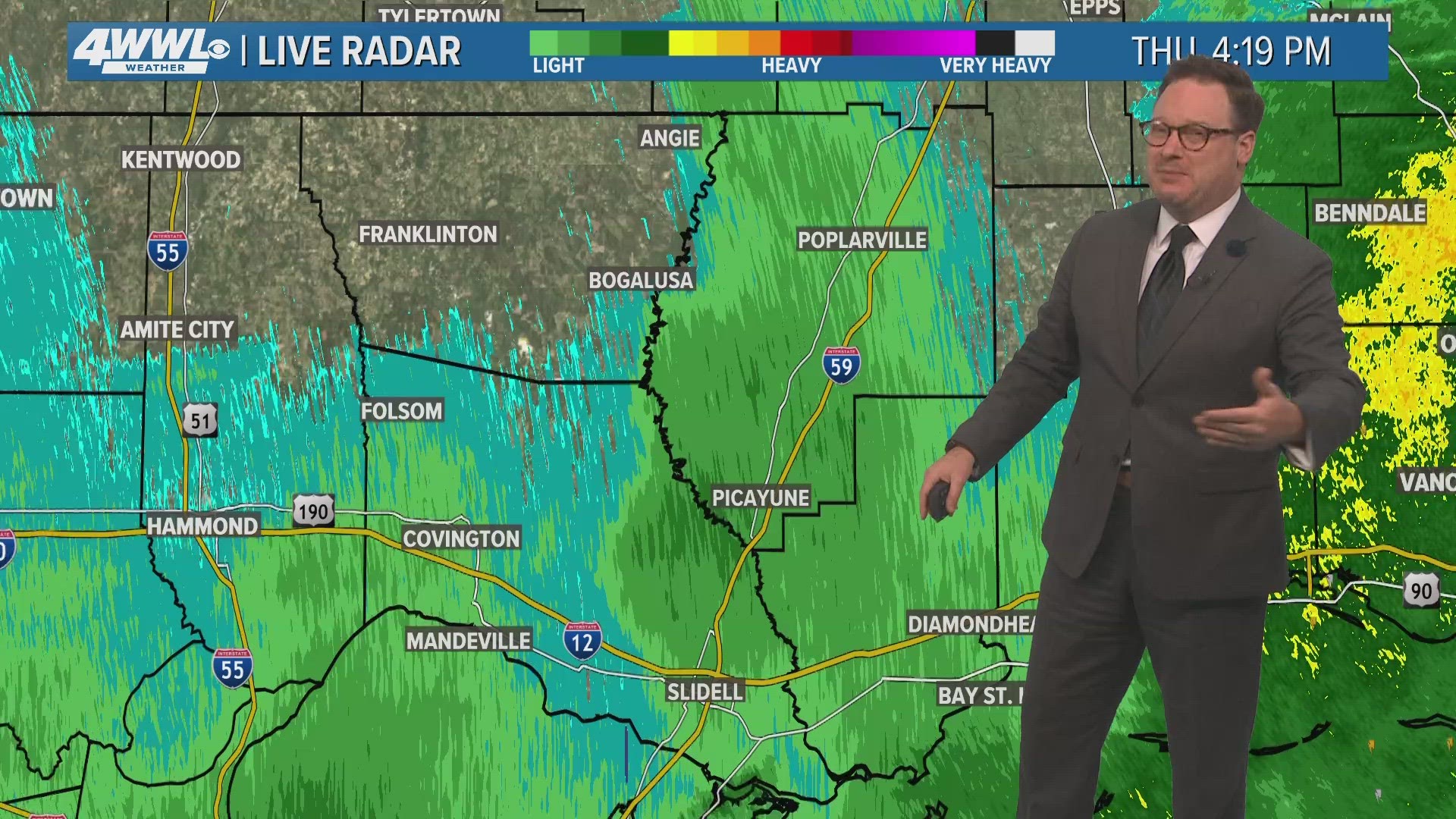
5:30 PM: WWL Chief Meteorologist Chris Franklin forecasts light rain Thursday evening as the bulk of the heavier downpours have long since moved east. A number of rivers on the Northshore have responded to the deluge from yesterday and are running at a moderate flood stage. Most are either near their crest or have already started to fall. The area will see another round of rain and some downpours Friday. WWL hi-res models keep most of tomorrow's rain on the Southshore and River Parishes. This would allow the river levels to continue to drop.
4:35 PM: Neutral ground parking is extended through Saturday at 6 PM. The NOLA Ready Ready Emergency Alert System is asking motorists not to block intersections, streetcar tracks, sidewalks, or bike paths.
2:55 PM: Plaquemines Parish officials issued a Lightning Alert for their area.
1:25 PM: The NOLA Ready Emergency Alert System issued a Dense Fog Advisory for portions of the coastal parishes in southeastern Louisiana from Terrebonne Parish through St. Tammany Parish, as well as Hancock, Harrison, and Jackson counties in coastal Mississippi. The advisory is in effect from midnight to 9 a.m. Friday.
The advisory warns motorists hazardous driving conditions could apply due to low visibility. If driving, slow down, use low beam headlights, and leave plenty of distance ahead of the vehicle.
12 PM: Latest update on severe weather, street flooding, sandbag distribution and potential rainfall still to come on WWL Louisiana News at Noon:
11:50 AM: St. Tammany President Mike Cooper releases statement on severe weather impacting parish:
"In the last 24 hours, we have received at least six inches of rain. Some areas were harder hit than others. We experienced a lot of street flooding, which has receded across most of the Parish. We are thankful that there were no reported injuries. Unfortunately, there are also a few homes that reported minor flooding."
11:45 AM: WWL meteorologist Alexa Trischler forecasts more rain and storms happening for the next couple of hours. Rain should taper off later this afternoon with a foggy and dry night on tap. Some flooding is still possible, especially over very saturated grounds on the Northshore and river parishes.
11 AM: Latest WWL weather forecast calls for 100-percent chance numerous showers and storms on Thursday. Some street flooding possible. Isolated strong to severe storm. Warm, humid. High: 73. Winds: SW 5-10 mph.
A Street Flood Advisory has been issued for parts of St. John The Baptist, Lafourche, Terrebonne, St. James, St. Charles, Assumption until 2 p.m.
10:50 AM: The Causeway reports that all fog cones and signs are out of the roadway. Expect delays.
10:45 AM: The Causeway - Northbound bridge is closed temporary to pick up fog cones and signs. Expect reopening in 15 minutes.
10:15 AM: Tangipahoa Parish provides list of road closures due to high water, and urge residents to avoid driving through flood waters or to go around barricades if a roadway has been posted for flood risk.
10 AM: Northshore deputies were providing welfare checks as St. Tammany Parish roads gushed with floodwaters.
A Severe Thunderstorm Warning has been extended for areas in Washington, Pearl River, Walthall until 10:45 a.m. Seek shelter indoors until the storm has passed.
9:15 AM: A Severe Thunderstorm Warning has been issued for areas in Washington, Tangipahoa, Walthall, Pike until 10 a.m. Seek shelter indoors until the storm has passed.
9 AM: With continued rain forecast, sandbags are being made available at locations in St. John and Tangipahoa parishes as need.
St. John Parish
- Sandbags are available, 8 a.m. to 5 p.m., at 425 Captain G. Bourgeois St. in LaPlace. This is a self-serve sandbag location. Please only take what is needed.
- Sandbags are also available for the elderly by calling Public Works during business hours at 985-652-4815.
Tangipahoa Parish
- Filled sandbags will be available at the Public Works building on West Pleasant Ridge Road in Hammond starting at 9 a.m.
- In Amite, sandbags will be available starting at 10 a.m., at the Florida Parishes Arena.
- For more information, call the Tangipahoa Parish Government at (985) 748-3211.
Wednesday afternoon, the city of Thibodaux offered sand and sandbags available at the Public Works Barn, located at 219 Henry S. Thibodaux Street, for residents to come fill as needed. Please contact Public Works at 985-446-7223 for further availability.
8 AM: WWL meteorologist Payton Malone posts video on social media showing Bogue Falaya. He says river will stay high the next several days as more rains on the way.
5:30 AM: Neutral ground parking remains in effect until 7 p.m. Thursday.
5 AM: A few showers and t-storms are possible Thursday morning, but more widespread rain arrives around midday and lingers through the early afternoon. It doesn't look as bad as Wednesday's rain total, but most pick up between 1-3 inches and any additional rain could lead to flooding.
4:30 AM Update: Dense Fog Advisory remains in effect until 9 a.m.
This is a developing story and will be updated.