
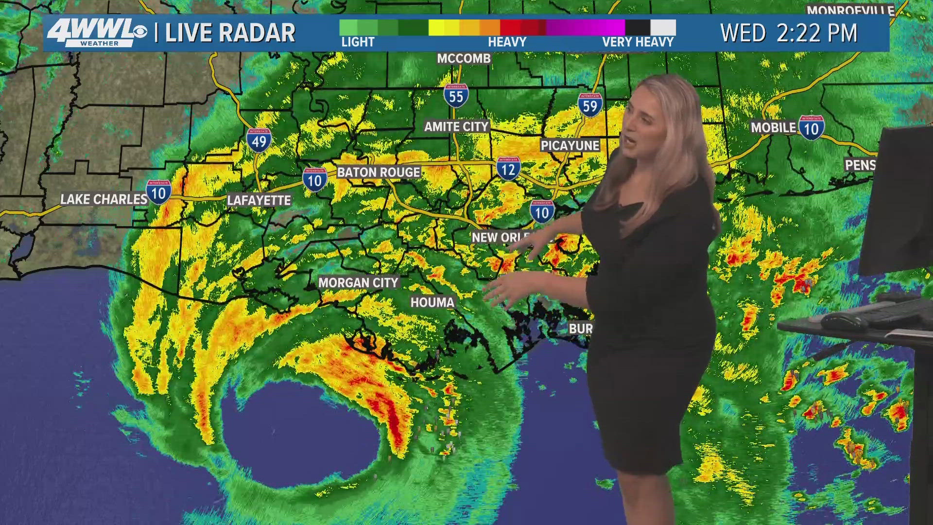
Hurricane Francine came ashore late Wednesday afternoon and lashed coastal and southeast Louisiana with winds up to 100 miles per hour and heavy, persistent rains that caused street flooding, knocked out power to more than 200,000 buildings and raised concerns about sewage backups in some metro New Orleans parishes.
A Flash Flood Emergency was issued for parts of Orleans, Jefferson and the river parishes around 8 p.m. as bands of rain from Francince temporarily halted over the area, dropping days worth of rain in about an hour's time.
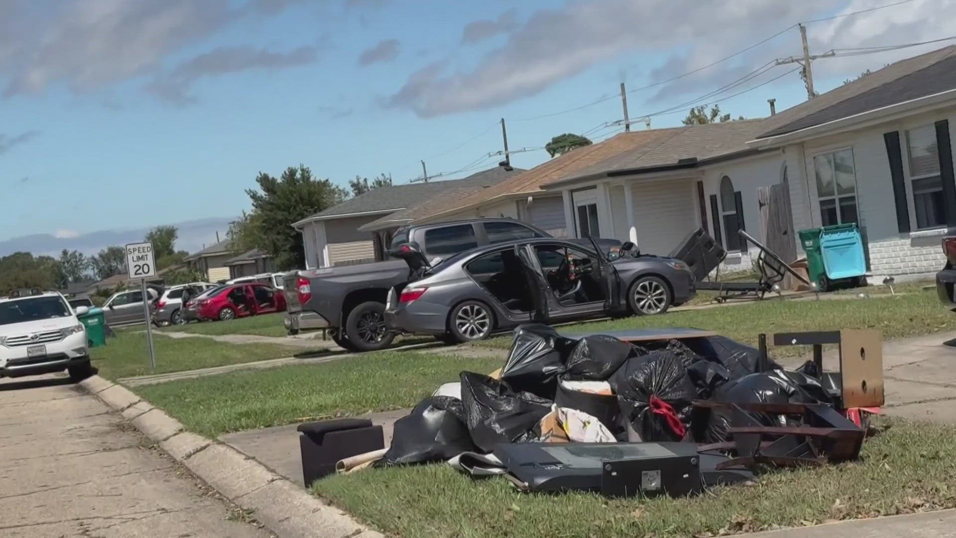
The emergency ended about an hour later but not before hundreds of homes were flooded, including more than 100 in St. Charles Parish, at least 20 in Jefferson Parish and that doesn't include Kenner. There were several in New Orleans as well but the full extent wouldn't be known until Thursday.
"Overall the pumps were working," said Jefferson Parish President Cynthia Lee-Sheng. "We were just outpaced by the rain."
In the city of Kenner, Police Chief Keith Conley said some water was waist deep and that he did not know how many homes and cars were flooded, but described the situation as "a big mess" that extended to every part of the city.
St. Charles Parish President Matt Jewel said he's hearing the amount of homes damaged in the parish is closer to 200, but he isn't sure if some of that was water pushed into homes by vehicles going down flooded streets.
He said the issues were parish-wide but cited Norco as particularly hard hit.
There were rainfall amounts Wednesday evening approaching 8-10 inches in parts of New Orleans, the east bank of Jefferson Parish and parts of the river parishes.
Winds gusted up to nearly 70 miles per hour at the lakefront and around 50 miles per hour at the Armstrong International Airport in Kenner, which had no flights entering or departing the city by midday.
By 8 p.m. WWL Louisiana Chief Meteorologist Chris Franklin said that conditions were going to start improving and would not be as bad as what was seen earlier in the evening.
Residents all along southeast Louisiana were advised to stay home and off the streets while the conditions were dangerous. Most schools, businesses and government organizations were closed as people waited all day for Francine, which started a few days ago in the Gulf of Mexico as just a blob of storms forecast initially for a southwest Louisiana landfall. But its track kept listing to the east and eventually it made landfall and then made its way perilously close to the heavily-populated Orleans, Jefferson and St. Tammany parishes.
The city of New Orleans, Jefferson Parish and Plaquemines Parish issued warnings asking residents to limit unnecessary water usage as water getting into the sewerage system threatened to send sewage backing up into people’s homes.
Francine faced several unfriendly conditions in the Gulf of Mexico, which, for most of the hurricane season was ripe to strengthen a storm with very warm waters. Some wind shear and dry air conditions kept it to a maximum of 100 mile per hour winds and Chris Franklin said they were hard, if not impossible to find.
With Francine coming on shore late afternoon and early evening into the night, much damage is likely hidden to people and will become more prevalent at first light Thursday.
It will be moving rather quickly with the center well north and likely improving conditions by late Wednesday and into Thursday.