This is a continuation of WWL-TV's live blog with the latest updates on Hurricane Barry in the Gulf of Mexico, the first major named storm of the 2019 hurricane season that's bearing down on the Louisiana coast.
For updates from the city of New Orleans on the storm, text Barry to 888-777.
Saturday, July 13:
- 11 a.m. - Our continuing coverage of Hurricane Barry is being moved to a new liveblog. You can stay up to date by clicking this link.
- 10:53 a.m. - Current models show that Hurricane Barry could dump up to four inches per hour in places throughout the state.
In New Orleans and Jefferson Parish, the pump systems can drain one inch of water in the first hour of a storm and a half inch every hour after that.
Thibodaux officials are still expecting eight to 10 inches of rain through Sunday.
- 10:44 a.m. - As part of our coverage of Hurricane Barry, we're taking you behind the scenes using Facebook Live interviews with the reporters who are on the front lines throughout the state.
Paul Murphy sat down with Jade Cunningham to break down the first day of the storm and what he's been seeing in St. Charles Parish, St. John Parish and in New Orleans.
Ed. Note: Story continues below the video
- 10:34 a.m. -
- 10:30 a.m. -
- 10:16 a.m. -
- 10:08 a.m. - As cows were being herded into a trailer behind him, Lt. Gov. William Nungesser told WWL-TV that the back levee in Myrtle Grove had been overflown in about 20 places, bringing floodwater into the evacuated area.
In Plaquemines Parish, herders in swamp boats are rescuing cows ahead of the heavy rains from Hurricane Barry.
Ed. Note: Story contines below the video
- 9:55 a.m. - Tropical Storm Barry has been upgraded to Hurricane Barry as it hits the Louisiana coast.
The Category 1 hurricane is the first hurricane to make landfall in Louisiana in seven years.
- 9:53 a.m. - The parish-wide curfew in Lafourche Parish will resume at 10 p.m. Saturday night and will continue through 6 a.m. Sunday.
- 9:50 a.m. -
- 9:35 a.m. - If you live in St. Charles Parish, just try to hold it.
Officials are urging residents to minimize their sewer usage because of storm-related power outages.
- 9:31 a.m. - Entergy has reported more than 60,000 people without power Saturday. The utility company said crews are having difficulty accessing some southern Louisiana areas because of flooding and impending heavy rain.
- 9:18 a.m. - Winds are picking up throughout Louisiana as Tropical Storm Barry bears down on the coast.
While wind is a concern, officials believe the biggest danger is water: up to two feet of rain is expected to fall in some areas.
- 9:07 a.m. - At least 100,000 sandbags have been distributed in St. Tammany Parish in preparation for Tropical Storm Barry.
- 9:02 a.m. - If you're in the New Orleans area, take your dog for a walk, bring the plants inside and get your car to high ground. This may be your last chance before the storm hits.
- 8:51 a.m. -
- 8:41 a.m. -
- 8:33 a.m. - The levee system near the Myrtle Grove and Pointe Celeste areas has been overtopped.
Those communities were placed under mandatory evacuation ahead of Tropical Storm Barry, which is beginning to damage southern Louisiana.
There are no failures of the levee system at this time.
- 8:18 a.m. -
- 8:14 a.m. -
- 8:03 a.m. - Curfews have been lifted in Lafourche Parish. Officials are still urging residents to stay off the roads if at all possible.
- 7:54 A.M. -
7:45 a.m. -
7:30 a.m. -
- Barry's track has shifted slightly west into the southern Louisiana coastline.
- Barry is forecast to make landfall as a Category 1 hurricane.
- Barry's west-northwest movement remains slow at 5 mph.
- Barry's winds have increasing to 70 mph.
- Barry's central pressure has also dropped to 991 mb.
- A landfall west of Morgan City is still forecast for Saturday morning around lunch time.
- Some of the larger thunderstorms are forming more closely to Barry's center.
The next advisory out from the National Hurricane Center is due out at 10
AM.
7:18 a.m. - All flights leaving and coming into MSY, Louis Armstrong International Airport, have been CANCELED
7:15 a.m. -
-7:02 a.m. -
-6:55 a.m. - New coordinates show Tropical Storm Barry has strengthened to 70 mph, but also say that it will not reach the 75 mph threshold for a cat 1 hurricane before it makes landfall
-6:45 a.m. - The US Coast Guard successfully rescued 12 people trapped in coastal Terrebonne Parish, according to TOHSEP Director Earl Eues. There were no injuries reported.
-6:35 a.m.-
- 6:25 a.m. - Water is over-topping the back levee system in Plaquemines Parish in the Myrtle Grove, Point Celeste area, Director of Homeland Security of Plaquemines Parish Patrick Harvey said on the Eyewitness Morning News.
- 6:03 a.m. - The U.S. Coast Guard mounts a rescue mission to save 12 people trapped in a coastal Louisiana community cut off by rising water from Tropical Storm Barry.
Sources tell Eyewitness News that four of the 12 individuals trapped on Isle de Jean Charles are elderly. The Coast Guard was preparing an air rescue but strong winds made the mission too dangerous Saturday morning. First responders are now considering other options to reach the trapped individuals. Read More
- 5:50 a.m. - With thousands without power and the storm just miles away, the Lafourche Parish Sheriff's Office gives a SitRep on Tropical Storm Barry:
- Over 5,000 residents without power
- Curfew in place until 8 a.m. this morning for most of parish (City of Thibodaux curfew lifts at 6 a.m.)
- Asking residents to remain indoors and off the streets unless absolutely necessary even after curfew is lifted.
- Overnight, deputies cleared several downed trees from roads – still plenty of debris on roadways.
- Primary Road Closures:
- LA 1 south of the Leon Theriot Locks in Golden Meadow
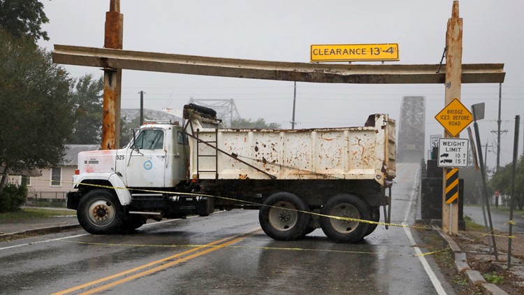
- Cote Blanche Pontoon Bridge in Cut Off
- Galliano Pontoon Bridge
- 5:45 a.m. - Delta Airlines cancels all flights from the Louis Armstrong New Orleans International Airport (MSY) for Saturday because of Tropical Storm Barry.
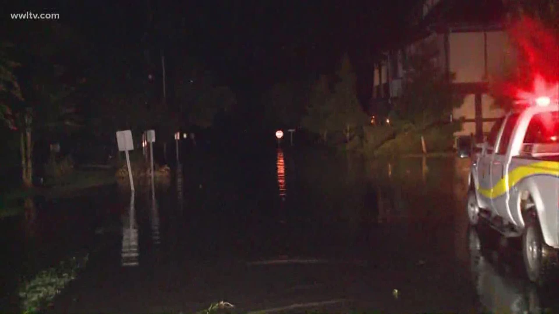
- 5:39 a.m. - Jefferson Parish Sheriff's Office officials said so far, all roads in the town of Lafitte, Louisiana are still passable -- except one. WWL-TV reporter Paul Dudley shows the water on Privateer Boulevard:
- 5:20 a.m. - In St. Tammany Parish, some streets near Lake Pontchartrain are already experiencing flooding from winds churned up by Tropical Storm Barry. Watch WWL-TV reporter Duke Carter on Lakeshore Drive in Mandeville:
- 4:50 a.m. - Winds are still at 65 mph and Tropical Storm Barry is still slowly moving WNW at 5 mph, The storm is forecast to make landfall later this morning, west of Morgan City.
- 4:25 a.m. - WWL-TV reporter Paul Dudley spots extensive street flooding in Lafitte and a downed tree on a power line on the 4000 block of Jean Lafitte Boulevard.
"Downed wires should be considered live. For your safety, please stay away. Crews will be there to assess the damage & repair as soon as it's safe to do so," an official with Entergy Louisiana said.
- 4:20 a.m. - More than 27,000 people are without power in parishes around Southeast Louisiana ahead of Barry's landfall, according to Entergy's online outage map.
More than 10,000 of those outages came from Terrebonne Parish alone:
- 4:10 a.m. - Tropical Storm Barry is nearly on land. WWL-TV's weather team will be live all day with the information you need to know as the storm makes its way onto Louisiana.
- 3:46 a.m. - The National Hurricane Center releases its 4 a.m. storm advisory, what most likely will be the last update before Tropical Storm Barry makes landfall around 7 a.m. as a category 1 hurricane.
- 3:21 a.m. - Mississippi Governor Phil Bryant has declared a State of Emergency in response to Tropical Storm Barry. A State of Emergency is an administrative tool that authorizes the use of state resources to aid in response and recovery efforts.
- 3:01 a.m. - The National Weather Service station in New Orleans has a stern message for residents preparing for the storm: "DO NOT drop your guard."
- 2:45 a.m. - Governor Phil Bryant has declared a State of Emergency in response to Tropical Storm Barry. A State of Emergency is an administrative tool that authorizes the use of state resources to aid in response and recovery efforts.
- 2:32 a.m. - People boarded up buildings, stocked up on water and braced for torrents of rain and punishing wind from a strengthening Tropical Storm Barry that threatened millions as it churned a path ashore and tested efforts to guard against flooding since Hurricane Katrina devastated New Orleans 14 years ago.
Officials predicted Barry would make landfall Saturday morning near Morgan City as the first hurricane of the season, with the edges of the storm already lashing Louisiana with rain and leaving some coastal roads underwater. Keep Reading.
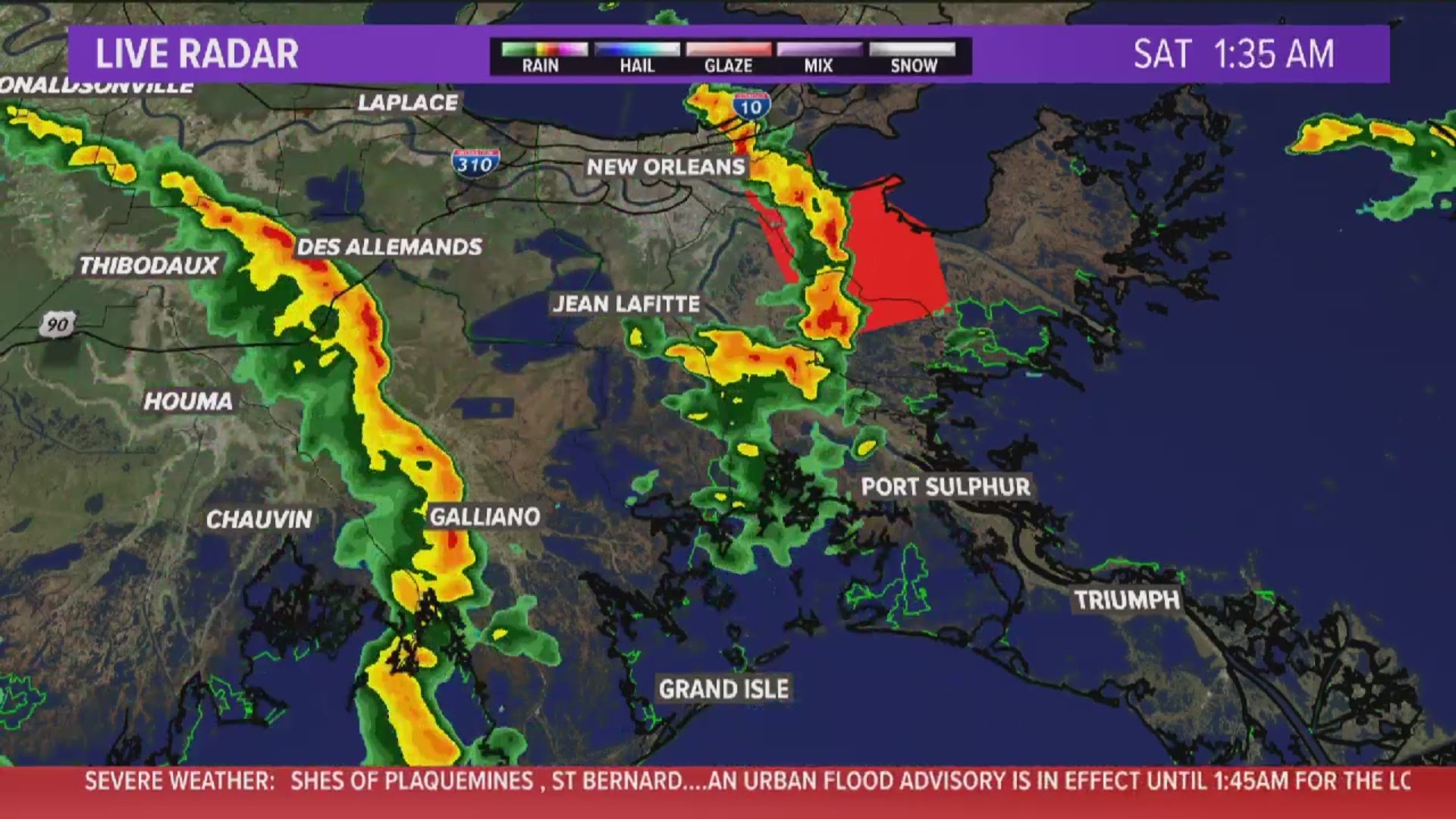
- 1:52 a.m. - Tornado warning extended until 2:15 for Plaquemines and St. Bernard parishes including Violet, Poydras, and Caernarvon.
- 1:30 a.m. - Tornado warning extended for Plaquemines and St. Bernard parishes until 2 a.m.
Ed. Note: Story continues below the image
- 1:20 a.m. - A tornado warning has been issued for Plaquemines and St. Bernard parishes until 1:30 a.m. More tornadic activity expected.
Ed. Note: Story continues below the image
- 1:10 a.m. - 17,500 people are without power. Here are the details about outages.
- 12:40 a.m. - The National Weather Service's 1 a.m. update:
- No big changes in wind speed, movement or pressure
- Landfall still forecast for Saturday morning west of Morgan City
- Shower activity has become slightly more organized during the past several hours
- Storm is located about 61 nautical miles SSE of Morgan City
- 12:30 a.m. - Verizon, AT&T providing unlimited calling, texting, data for customers impacted by the storm. Read the full story for details.
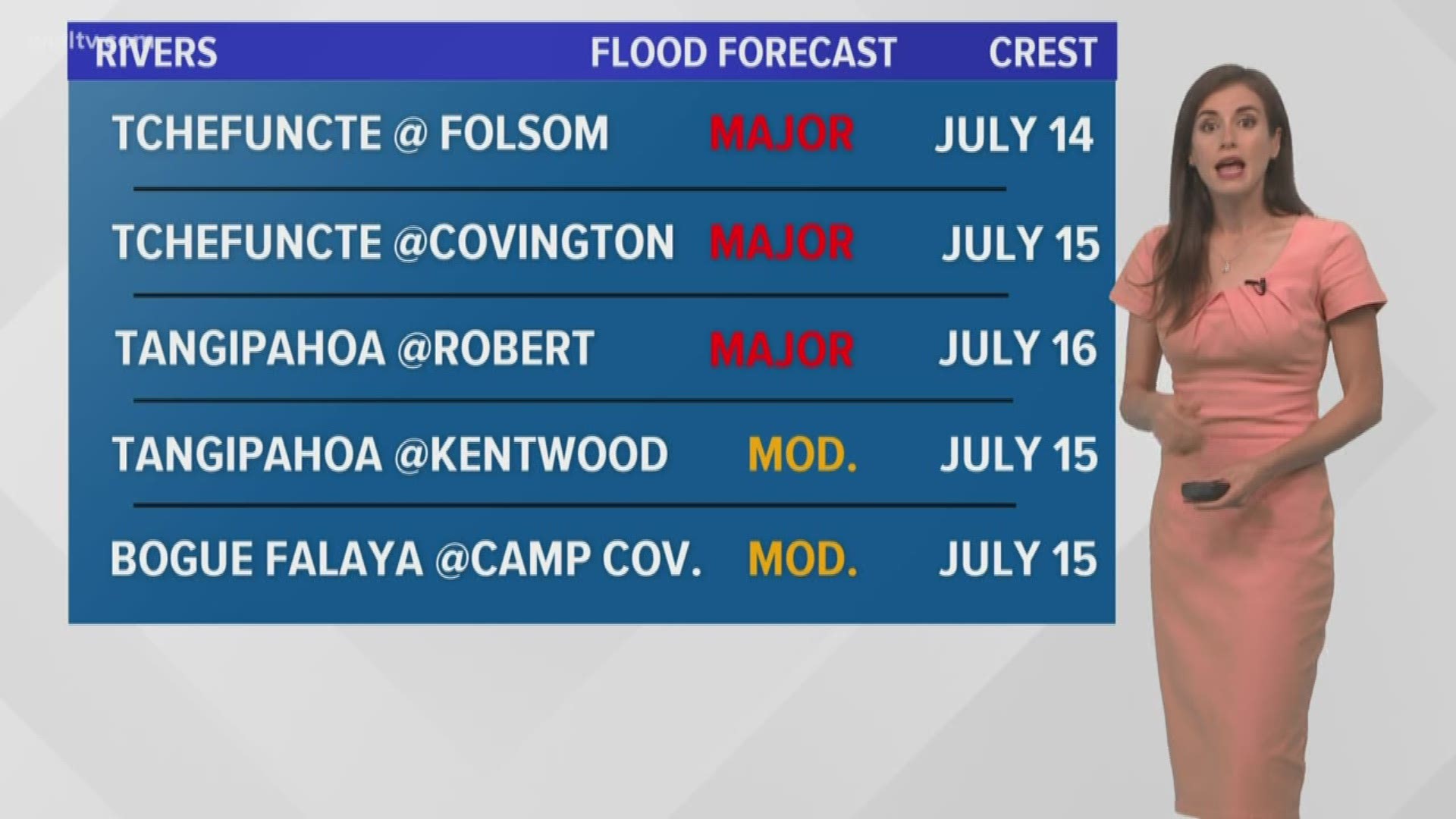
- 12:10 a.m. - WWL-TV Meteorologist Alexandra Cranford is reporting that the Tchefuncte River at Folsom is projected to crest at 24 feet Sunday.
The Tangipahoa River at Robert is projected at 21 feet Tuesday - right at major flood stage but well below the record level.
Ed. Note: Story continues below the image
- 12:03 a.m. - Barry is still expected to be a Category 1 hurricane when it makes landfall in Morgan City later this morning.
Friday, July 12:
- 11: 54 p.m. - WWL-TV Meteorologist Alexandra Cranford is reporting that the Tchefuncte River at Covington is projected to crest at 30.5 feet on Monday.
Ed. Note: Story continues below the image
- 11:50 p.m. - St. Tammany Parish Emergency Management Director Dexter Accardo: We're taking it seriously, we're ready to go, we've had countless meetings, the national guard is participating with us with high water vehicles and boats, we're ready to get after it if we have to.
Everybody should have a family plan and stay informed. Don't think just because it hasn't rained that it's not going to happen.
- 11:45 p.m. - 40 mph wind gusts reported in Lakefront
- 11:30 p.m. - 16,300 people are without power ahead of Tropical Storm Barry. Here are details about outages.
- 11:21 p.m. - I-610 eastbound exit ramp at Franklin Avenue in Orleans Parish is closed for impending weather, according to DOTD. Here are all the road closures and roads being closely monitored.
- 11:09 p.m. - WWL-TV Reporter Caresse Jackman is seeing some street flooding in Jean Lafitte.
Ed. Note: Story continues below the image
-11:15 p.m. - The Delta Sigma Theta sorority found a silver lining in the soggy situation. After their convention was canceled, there were more than 17,000 meals left over. So the sorority worked with Centerplate food services and a local chef to have the food picked up by Second Harvest Food Bank ahead of the storm making landfall. Read the full story.
- 11: 07 p.m. - 179 have been canceled at New Orleans International Airport Friday, according to FlightAware.
- 11 p.m. - Hospitals and emergency rooms will remain open but many clinics are closed.
- 10:53 p.m. - WWL-TV Meteorologist Alexandra Cranford is reporting Saturday's expected rain chances for the metro area:
- 50% at 7 a.m.
- 70% at noon
- 80% at 5 p.m.
- 10:50 p.m. - After the city of New Orleans didn't provide sandbags ahead of Tropical Storm Barry, residents and businesses got creative and helped each other out:
Ed. Note: Story continues below the image
- 10:40 p.m. - More than 15,000 people are without power in Jefferson, Lafourche and Terrebonne parishes.
- 10:24 p.m. - Tornadic activity is something we're watching tonight and early Saturday before the heavy rain.
The National Weather Service said the forecast crest for the Mississippi River is now 17.1 feet and will occur Monday due to heavy rains expected this weekend.
Ed. Note: Story continues below the image
- 10:16 p.m. - As the storm approaches, a question arose for many residents in the path: Is the gas surge we are seeing before Tropical Storm Barry makes landfall considered price gouging?
The short answer is no. We looked into the question and created a Verify for viewers to understand more. Keep reading
-9:35 p.m. - WWL-TV Meteorologist Alexandra Cranford is reporting that hydrologists at the National Weather Service are saying the Mississippi River in New Orleans has already crested in New Orleans from storm surge at just below 17 feet, nearly two feet below where previously expected.
The river level could rise a little bit, perhaps to just over 17 feet, due to rainfall.
-9:30 p.m. - Southwest Airlines cancels flights out of Armstrong Airport. Other airlines have canceled some. Check your flight status
-9:20 p.m. - No RTA service in Orleans or Jefferson Parish from now through Saturday
-9:08 p.m. - Impressive display of preparedness in Jean Lafitte in lower Jefferson Parish
Ed. Note: Story continues below the image
- 8:53 p.m. - Planning to run a generator if your power goes out? We've got you covered.
- 8:45 p.m. - Fire department officials confirmed that a driver struck and ruptured a four-inch gas pipe on West Esplanade Avenue in Metairie Friday night.
The driver fled the scene, but was found by deputies with the Jefferson Parish Sheriff's Office and taken into custody.
Crews are working to repair the pipe, but because of its size, officials say it will take time - time they may not have ahead of Tropical Storm Barry's expected landfall. The first heavy rain is expected to reach the New Orleans area overnight.
- 8:42 p.m. - Authorities confirmed a vehicle in Metairie crashed near the canal along the roadside and struck a gas pipe in the canal.
Crews have blocked off several streets near West Esplanade and Transcontinental while they work to repair the pipe and retrieve the car.
The circumstances of the crash were not clear Friday night.
- 8:29 p.m. - Thousands of people are without power in Jefferson and Terrebonne parishes Friday. Entergy officials have said throughout the week that they expect power outages lasting hours or days could be a relatively common occurrence in areas where floodwaters prevent crews from getting to equipment to conduct repairs.
- 8:26 p.m. - Baton Rouge is facing the calm before the storm ahead of Tropical Storm Barry.
While some coastal areas are seeing rough waves and wind, the state capital is still calm even as dark clouds begin gathering at dusk.
- 8:12 p.m. - Lake Pontchartrain is facing high winds and rough waves stirred up by the oncoming Tropical Storm Barry.
Ed. Note: Story continues below the image
- 7:49 p.m. - Joseph Giarrusso, the New Orleans City Council member for District A, urged New Orleans residents to stay off the roads after 8 p.m. while on-air with WWL-TV.
While the city is not under a curfew, Mayor Latoya Cantrell has urged residents to finish gathering supplies for the storm by 8 p.m. Friday.
Ed. Note: Story continues below the video
- 7:29 p.m. - About 1,000 Entergy customers near Grand Isle are without power. The area is under a mandatory evacuation order, but some residents have chosen to stay.
- 7:24 p.m. - Mississippi has declared a state of emergency ahead of Tropical Storm Barry's projected landfall in neighboring Louisiana.
The western border of the state is expected to receive a large amount of rain as the storm moves north.
- 7:10 p.m. - Here's the latest update on Tropical Storm Barry as it sits in the Gulf of Mexico. WWL-TV Forecaster Chris Franklin broke down the latest data from the National Hurricane Center on Channel 4.
Ed. Note: Story continues below the video
- 7:05 p.m. - Jefferson Parish crews cleaned 3,100 catch basins throughout the parish Friday. In total, 8,000 catch basins have been cleaned, Parish President Mike Yenni said at a press conference.
Nearly all of the parish's pumps - 189 of 190 - are working ahead of the storm, he said. Yenni said the operational pumps could fill the Smoothie King Center in six minutes, and fill the Superdome in 41 minutes.
All floodgates in the parish - as well as all floodgates in Orleans and St. Bernard parishes - have been closed as of 6:15 p.m.
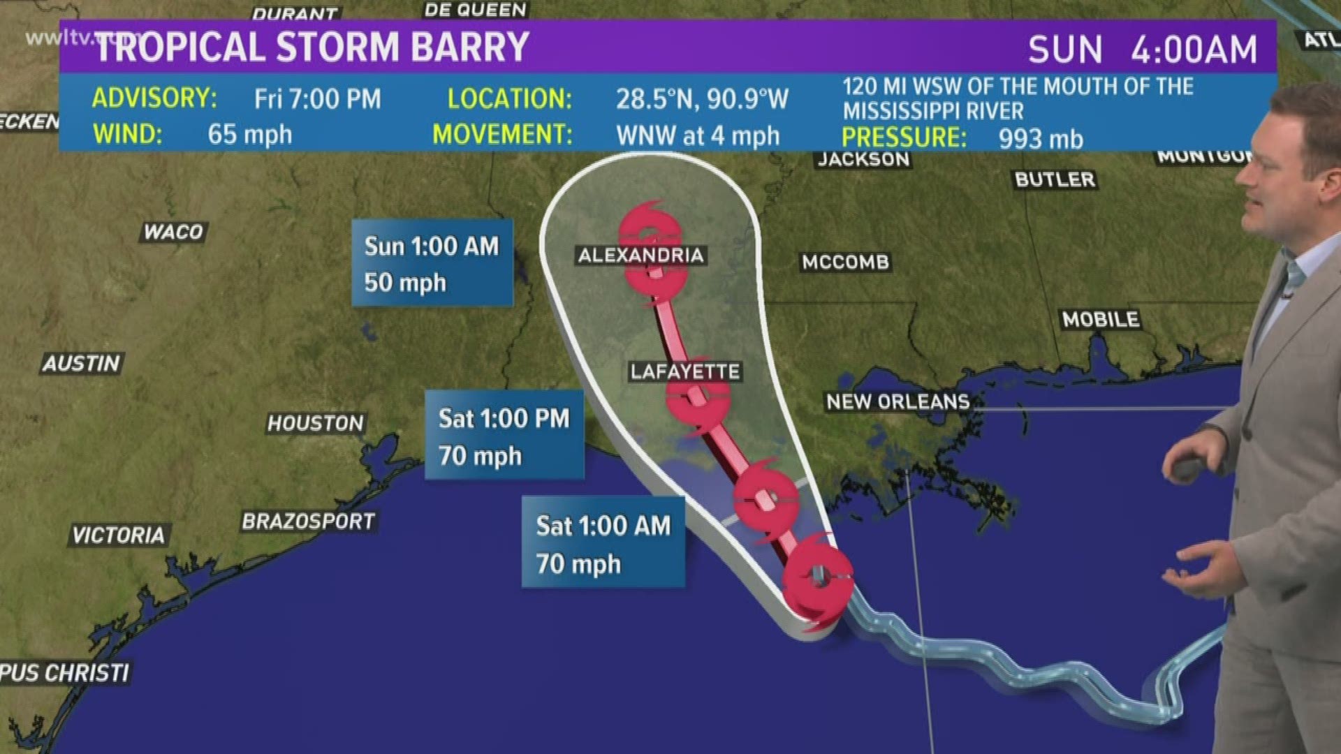
- 6:58 p.m. - According to the latest data from the National Hurricane Center, Tropical Storm Barry is stationary in the Gulf of Mexico, about 85 miles away from Morgan City.
The storm did not become more powerful either, with wind speeds remaining constant at 65 mph.
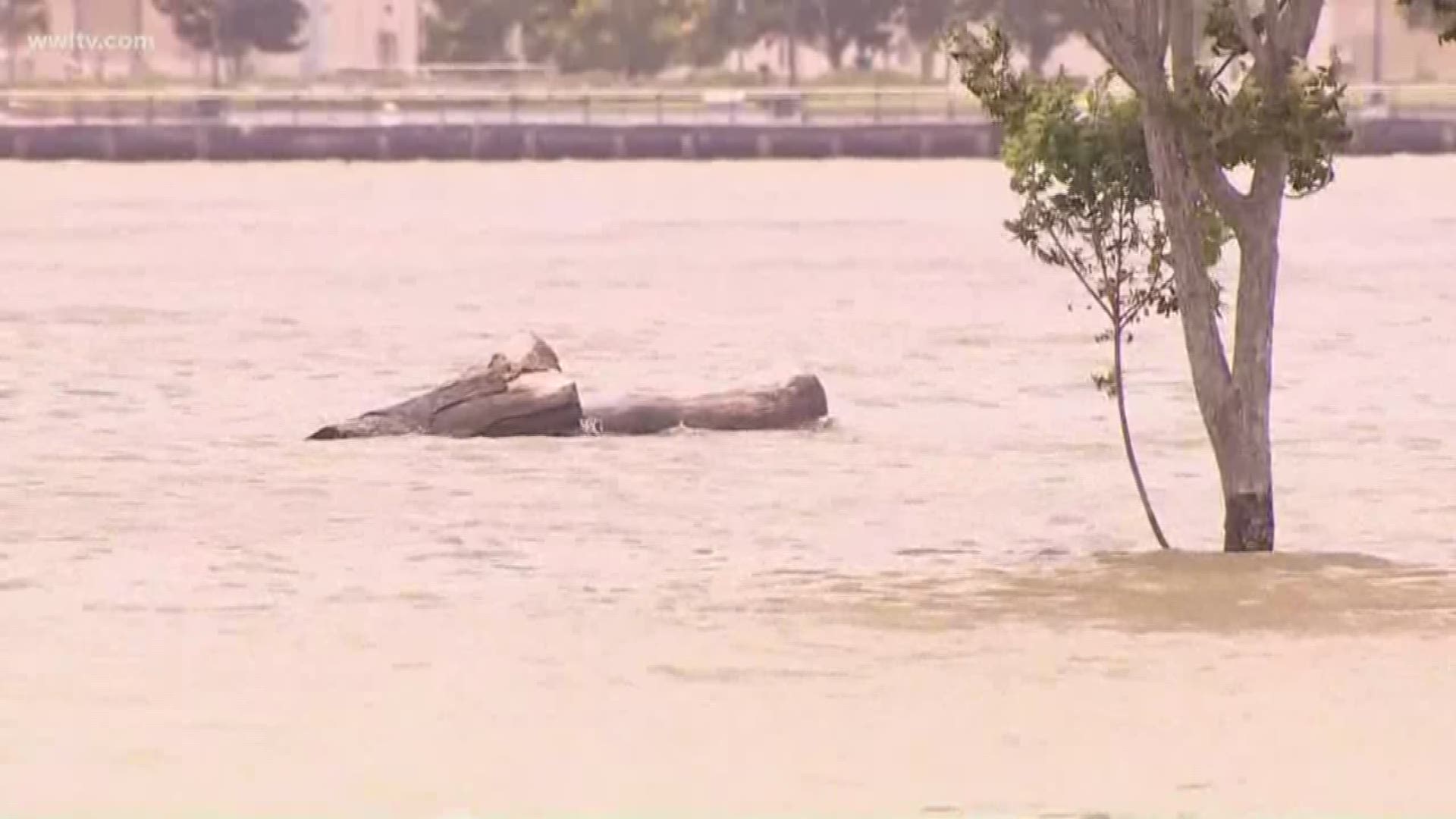
- 6:50 p.m. - Now that's a high river.
Ed. Note: Story continues below the image
- 6:46 p.m. - Tropical Storm Barry is set to make landfall around 7 a.m. Saturday between Lafayette and Morgan City, Louisiana.
Barry is forecast to continue to strengthen into a hurricane before making landfall. After landfall, the storm will steadily weaken as it moves inland.
- 6:33 p.m. - All Southwest flights out of the New Orleans Airport have been canceled through Sunday, airline officials confirmed.
The New Orleans Airport is still open and operational Friday night, with airport officials saying they would decide on a day by day basis whether the airport will remain open.
- 6:24 p.m. - The Red Cross has opened three evacuation centers for people impacted by Tropical Storm Barry, which is expected to make landfall sometime early Saturday.
- 6:18 p.m. - As Tropical Storm Barry approaches the Louisiana coast, the Coast Guard rescued three people in Mississippi after their boat ran aground.
Watch the video here: VIDEO: Coast Guard rescues 5 boaters as Tropical Storm Barry closes in on Louisiana
- 6:07 p.m. - For any questions you have about your specific area or situation, WWL-TV has set up a dedicated Tracking Tropical Storm Barry hotline.
You can call 504-529-6450, and we’ll have someone answer your call and help you figure out what you need to know.
- 6 p.m. - Pedestrians braved the winds in New Orleans Friday, clutching at hair and running for cover on Canal Street.
Ed. Note: Story continues below the video
- 5:55 p.m. - The Gulf Coast Center for Law & Policy has set up a GoFundMe to assist people impacted by Tropical Storm Barry.
- 5:43 p.m. - New Orleans residents are stopping by to check out the river levels, which are expected to rise up to 19 feet by noon on Saturday.
Ed. Note: Story continues below the video
-5:27 p.m. - The Port of New Orleans is closed. The Coast Guard closed the port at 5 p.m. They announced a "Port Condition Zulu," which is the heaviest restriction able to be placed on the port.
- 5:26 p.m. - New Orleans Airport administrators plan to continue operating Saturday, despite a number of canceled flights. They plan to evaluate the storm day by day to decide on any closures.
- 5:23 p.m. - Gov. John Edwards issued an executive order Friday suspending some regulations in the state on vehicles with large loads. The move is an attempt to ease the movement of equipment and supplies to areas hit by Tropical Storm Barry.
The executive order will last through Friday, July 26.
- 5:07 p.m. - St. Bernard Parish Sheriff James Pohlmann urged residents to stay off the road at a press conference as Tropical Storm Barry approached.
"Once that rain starts, it's not likely to stop," he said.
- 5:03 p.m. - Heavy rain from Tropical Storm Barry is expected to cause several rivers on the Northshore to rise into flood stage by Saturday.
- 4:58 p.m. - The flood authority has closed Highway 46. Lakeshore Drive is now closed to the public. Gate L1 on Lakeshore Drive remains open, but officials are looking to close it by 6 p.m.
- 4:54 p.m. - Here's a good number to keep handy. Crisis cleanup has put out a hotline for homeowners to call after Tropical Storm Barry has passed if they need help cleaning up their property.
- 4:30 p.m. - Around 1,500 Entergy customers throughout New Orleans are without power as city residents prepare for the coming storm. It is unclear when power will be restored to the impacted customers.
- 4:26 p.m. - The New Orleans Police Department has begun closing streets that are prone to flooding, ahead of the expected deluge of rain dropped by Tropical Storm Barry.
- 4:03 p.m. - Houston is preparing to help New Orleans cope with Tropical Storm Barry.
The Texas city, which took in 150,000 evacuees after Hurricane Katrina and accepted New Orleans' help when Hurricane Harvey struck the lone star state in 2017, is calling for donations ranging from diapers to batteries to bottled water.
The items will be delivered directly to New Orleans, Houston city officials said.
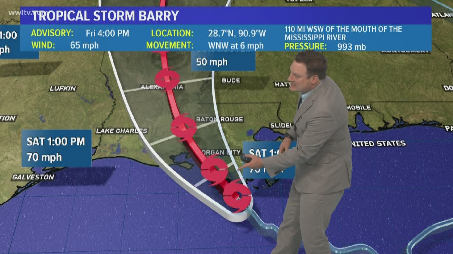
- 3:58 p.m. - Here is the latest update on Tropical Storm Barry as WWL-TV meteorologist Chris Franklin breaks down the 4 p.m. update from the National Hurricane Center.
Ed. Note: Story continues below the video
- 3:41 p.m. - The 4 p.m. update from the National Hurricane Center shows Tropical Storm Barry is about 70 miles from making landfall at Morgan City. The storm is now expected to stay a tropical storm when it makes landfall, but there is room in the new prediction for the storm to strengthen just before it hits the Louisiana coast into a Category 1 hurricane.
- 3:18 p.m. - Jefferson Parish Transit will be shutting down public transportation around the parish at 8 p.m. Friday.
RTA has already said they would be shutting down bus service throughout New Orleans at 8 p.m.
- 3:05 p.m. - No, you're not getting ripped off on gas prices ahead of Tropical Storm Barry. The increase in prices you're seeing is due to the closure of some Gulf oil rigs, rather than artificial inflation.
- 3:01 p.m. - Dry air above the Gulf of Mexico is preventing the bands of storms ahead of Tropical Storm Barry from producing large amounts of rain Friday. Meteorologists believe the rain will pick up as the storm nears the Louisiana coast ahead of its expected landfall Saturday morning.
- 2:50 p.m. - The Highway 90 floodgate is expected to be closed at 6 p.m., effectively cutting off the Venetian Isles, according to Collin Arnold from the New Orleans Emergency Operations Center.
Highway 11 was closed earlier Friday amidst storm surge concerns.
- 2:39 p.m. - NOPD and NOFD units are preparing to shut down some of New Orleans' frequently flooded roads ahead of the 10 to 20 inches of rain Tropical Storm Barry is expected to dump on the city over the weekend.
Flooded roads are dangerous and should never be driven through.
The city has urged residents to be inside and hunkered down by 8 p.m. Friday night.
- 2:13 p.m. - Entergy officials said about 100 customers lost power in the French Quarter for less than five minutes Friday afternoon as some of the load on the power grid was shifted around ahead of Tropical Storm Barry.
The outage was a byproduct of proactive work by Entergy to avoid power loss during the storm.
- 2:03 p.m. - RTA has confirmed all bus service will end in New Orleans at 8 p.m. Friday. They shut down ferry and streetcar service Thursday ahead of the storm, replacing them with bus routes.
Those additional bus routes will also be shut down ahead of the storm.
- 1:51 p.m. - Hancock County has opened an emergency evacuation center - the Kiln Shelter - for residents impacted by Tropical Storm Barry.
The shelter is located at 18320 Highway 43 Kiln, MS 39556.
Pets are not allowed at the shelter.
- 1:30 p.m. - The Orleans Parish School Board has canceled a Monday late enrollment event at Dillard University due to Tropical Storm Barry. This is the first instance of a Monday closure due to the storm.
Most of the locations that were set to be closed for the storm said they would reopen Monday.
- 1:21 p.m. - Terrebonne Parish is under a curfew from 10 p.m. Friday to 10 a.m. Saturday, according to Sheriff Jerry J. Larpenter.
During the curfew, only authorized emergency vehicles, such as police, fire and EMS will be allowed on the roads in Terrebonne Parish.
The sheriff said he would provide an update on Saturday on whether the curfew would be extended.
- 1:15 p.m. - Parts of the French Quarter had power cut ahead Friday, ahead of the projected flooding from Tropical Storm Barry.
- 1:04 p.m. - Entergy officials confirmed 1,600 people in Bridge City were without power Friday afternoon. A spokesperson for the utility company said they are beginning to see the impact from Tropical Storm Barry.
Crews are on scene and working to determine the cause of the Bridge City outage.
- 12:50 p.m. - Tropical Storm Barry is about 100 miles away from Morgan City, where it is expected to make landfall sometime Saturday morning. The storm is expected to strengthen into a Category 1 hurricane by the time it makes landfall, before weakening as it makes its way inland.
- 12:45 p.m. - Water levels at Algiers Point appear to be about a foot below the levee as storm surge from Tropical Storm Barry makes its way up the Mississippi River.
- 12:38 p.m. - One of the Franklin Avenue pumps is not operational Friday afternoon, Sewerage & Water Board officials said. It was unclear if it would be repaired in time to clear floodwater from Tropical Storm Barry.
- 12:13 p.m. - Some flights out of the New Orleans Airport have been canceled Friday afternoon. Officials are reminding travelers that the airport is not a storm shelter and nobody will be allowed to shelter in place in the terminals if they do not have a registered flight.
- 12:07 a.m. - 1,100 national guardsmen are stationed in New Orleans. The rest of the 3,000 mobilized by the Louisiana National Guard have been deployed throughout the path of Tropical Storm Barry.
- 12:05 p.m. - All St. Bernard and Orleans Parish floodgates have been closed, officials at the New Orleans storm press conference said.
Sewerage & Water Board officials said they were confident their system would work as designed during the storm, but urged residents to prepare for their own safety.
- 11:51 a.m. - Local supermarket Breaux Mart's stores are closing at 3 p.m. in the metro New Orleans area ahead of heavy rain and flooding expected this weekend.
- 11:42 a.m. - Members of the volunteer group calling themselves the Cajun Navy are working in Baton Rouge to fill sandbags ahead of Tropical Storm Barry.
The group, formed after Hurricane Katrina, uses their own boats to rescue people from floods in Louisiana, Texas, Florida and other southern states.
The founder of one branch of the loosely-organized group, United Cajun Navy, told WWL Radio that many Louisiana members are scrambling to protect their homes as m Barry approaches, so out-of-state members are heading to Louisiana to be ready. Todd Terrell says the group has volunteers from seven states.
- 11:34 a.m. - Mayor Latoya Cantrell says there has been little change to the storm since their conference Thursday, but urged residents to prepare now, because the storm will remain over New Orleans for several days, causing flooding throughout the city.
Cantrell said 8 p.m. Friday should be the cutoff for residents to prepare for the storm. After that time, she said, anybody in New Orleans should be prepared to stay where they are for up to 72 hours.
- 11:30 p.m. - Seabrook Bridge near New Orleans East is closed through the duration of the storm. RTA bus service will be detouring around the closed bridge while they remain operational.
- 11:14 a.m. - Parts of St. John Parish are under voluntary evacuations as residents prepare for the storm. Residents are watching for tornados, but tell WWL-TV they are more concerned about water.
Most of the homes in the evacuation area are built to withstand the storm, but residents believe if the roads flood, they could become trapped.
- 11:09 a.m. - Zephyr Field in Metairie is a staging area for anybody rescued from floodwaters over the weekend. Busses are setting up in the area, prepared for any issues.
- 11:05 a.m. - Around 1,300 people in the St. Roch area are without power Friday. Entergy crews are aware of the outage and working to resolve the issue ahead of heavy rain and flooding caused by Tropical Storm Barry.
- 10:53 a.m. - The Louisiana Restaurant Association is urging restaurants to use the social media hashtag #BarryEats to give updates on whether their businesses are open or closed, or any menu changes because of the storm.
-10:48 a.m. - A downed utility pole in Chalmette is impacting a relatively small number of Entergy customers Friday morning. Around 50 people are without power according to Entergy's outage map.
Remember, if you see downed power lines or any electrical equipment, always assume it is live and avoid it.
- 10:42 a.m. - Water is beginning to climb onto the roads in Lafourche Parish, where mandatory evacuations have been called for low-lying areas.
Ed. Note: Story contines below the video
- 10:39 a.m. - Lake Pontchartrain is starting to get choppy ahead of high winds and heavy rain expected soon.
Ed. Note: Story continues below the video
- 10:26 a.m. - Here's a look at Baton Rouge, where WWL-TV is preparing for a press conference with Gov. John Edwards at 12:30 p.m.
The city is expected to get at least 10 inches of rain, and will likely get much more over the next two days.
Ed. Note: Story continues below the video
- 10:17 a.m. - The Rolling Stones have pushed back their scheduled concert in New Orleans to Monday amidst flooding concerns over Tropical Storm Barry.
All Superdome tickets for their original Sunday show will be honored at Monday's show.
- 10:07 a.m. - A New Orleans resident shared a photo with WWL-TV that appeared to show an alligator preparing to ride out the storm on the man's houseboat in the west end of New Orleans.
Ed. Note: Story continues below the photo


If you see a gator, or any other wild animal, do not approach it. Animals are also trying to seek higher ground in the storm, but dangerous animals can be aggressive when driven out of their natural habitats.
- 10:01 a.m. - Highway 11 is expected to be barricaded in New Orleans East as crews work to close a floodgate.
- 10 a.m. - New advisory from the National Hurricane Center
- BIG changes from the earlier advisory.
- Barry's winds are now sustained at 65 mph, that is a 15 mph jump in 3 hours!
- Barry's west-northwest movement has not changed, remains at 5 mph
- The center, which still is organizing and is showing signs of thunderstorms beginning to form around it, has moved more west than north.
The strongest winds are still displaced from the center of the storm, which would need to happen when the storm intensifies.
The slow speed of the storm is no surprise - that was expected.
The next advisory coming down from the National Hurricane Center at 1 PM CDT.
For anything before 10 a.m. on Friday, July 12, click here.
Tropical Storm Barry's wind and rain were starting to hit parts of Louisiana early Friday as New Orleans and coastal communities braced for a drenching from what's expected to be the first hurricane of the season.
A hurricane warning was in effect along the Louisiana coast, and forecasters said the storm could make landfall as a hurricane by early Saturday.
National Hurricane Center Director Ken Graham said pockets of Louisiana could have as much as 25 inches of rain.
"So here's the takeaway: Dangerous situation," he said during an online presentation Thursday. "That kind of rainfall in this system could cause flash flooding, cause ponding of water."
Download the FREE WWL-TV News app now in the iTunes store or on Google Play for tropical weather updates through hurricane season.


