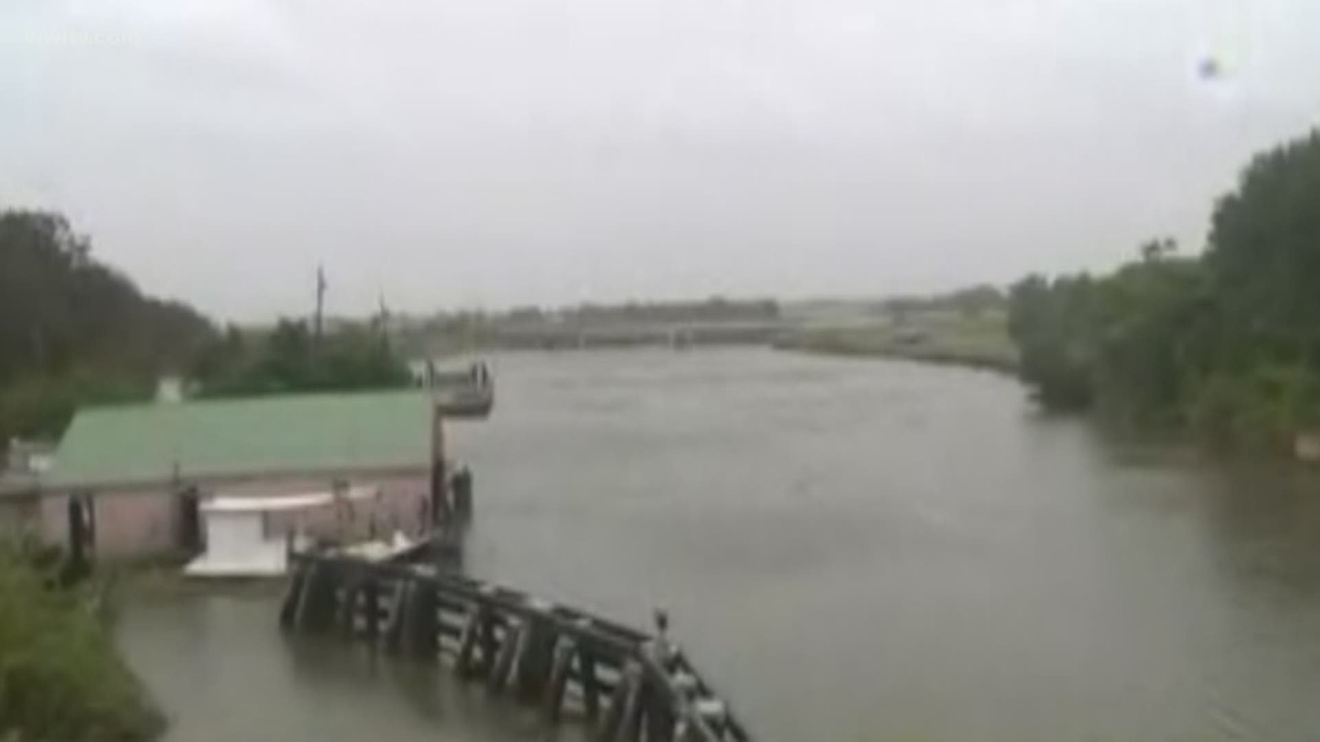
NEW ORLEANS — This is a continuation of WWL-TV's live blog with the latest update on Hurricane Barry as it continues to weaken and move out of the state. Barry was the first major named storm of the 2019 hurricane season.
For updates from the City of New Orleans on the storm, text Barry to 888-777
Sunday, July 14:
- 9:17 p.m. - There are 28,000 Entergy customers who remain without power in Louisiana, with the largest concentration in the Bayou Region parishes and the Greater Baton Rouge area, officials said.
Since Barry first started affecting Louisiana, Entergy has restored more than 235,000 customer outages, they said.
Cleco officials report that at the height of Tropical Storm Barry roughly 63,000 customers across the state were without power. Now, the company has restored power to approximately 30,000 of those customers. 14,000 customers in St. Mary Parish remained without power.
- 7:36 p.m. - All Audubon Nature Institute Facilities will be open Monday (7/15), this includes Audubon Zoo, Audubon Louisiana Nature Center and Audubon Park Clubhouse Golf Course and Tennis Courts.
- 7:27 p.m. - "We were prepared and we're thankful the worst case scenario didn't happen," Louisiana Governor John Bel Edwards said.
Highlights:
- 107 floodgates of the 601 that were closed have begun opening in Lafourche and Terrebonne parishes and the greater New Orleans area
- 93 individuals were saved from 11 parishes during the storm. No deaths were reported.
- 48 of those rescued came from one facility, a elderly living facility in Iberia Parish evacuated in the early hours of Sunday morning
- 188,000 people have had power service restored around the state, many of which were restored more than once. Tens of thousands are still out.
- The power restoration process is slowed because bucket trucks can’t operate in high winds
- 6:42 p.m. - The Louisiana State Police are investigating after Houma police officers assessing damage from Tropical Depression Barry were shot at from a moving vehicle and returned fire, officials said.
According to Houma Police Chief Dana Tymone Coleman, officers were around West Street Sunday around 2 p.m. to look at damages in the area from Barry, which shortly elevated to a category one hurricane on Saturday afternoon.
Coleman said officers heard several gunshots while on the street, "...some of which were extremely close whizzing by them." Read More
RELATED: Police officers shot at during Barry cleanup in Houma, Chief says; State police investigating
- 5:34 p.m. - Gov. John Bel Edwards gives an update on the impacts of Tropical Depression Barry as it leaves the state to the north, including power outages that are ongoing across Louisiana.
- 5:19 p.m. - Delgado officials announce all Delgado Community College locations will reopen Monday, July 15 on a normal schedule.
- 4:55 p.m. - The Jefferson Parish Schools System announces that all schools and offices in Jefferson Parish Schools will resume normal their summer operating schedule Monday, July 15 with the exception of Grand Isle School, Fisher Middle-High, and Kerner Elementary.
- 4:32 p.m. - The City of New Orleans announces that the New Orleans Public Library and NORD facilities will remain closed throughout Sunday but reopen Monday with regular hours of operation.
- 4 p.m. - The National Hurricane Center releases its 4 p.m. advisory:
- 3:47 p.m. - Hancock County's Kern Shelter has been closed.
- 3:29 p.m. - Evacuation orders for Grand Isle, Lafitte, Crown Point, Barataria and the Town of Jean Lafitte have been lifted. Grand Isle’s curfew remains in place from dusk to dawn while power is restored to the area.
All mandatory evacuations have been lifted, and the only evacuation order currently operating is a voluntary evacuation order in St. Charles Parish.
- 3:14 p.m. -
- 2:38 p.m. - LSU will reopen Monday, and classes are scheduled to resume as usual.
- 2:35 p.m. - Rain from a weakened Barry is expected to hit New Orleans Sunday night, with some showers set to bring water to the city Monday.
- 2:24 p.m. - According to the Lafourche Parish Sheriff's Office, the Côte Blanche Pontoon Bridge in Cut Off and the Galliano Pontoon Bridge are back in service and are open to vehicular traffic
- 2:20 p.m. -
- 12:39 p.m. - Ferry service in New Orleans is set to resume at 1 p.m. Sunday.
- 11:40 a.m. - The Houma Police Department is reminding residents that looters never prosper.
The department has released mugshots of several people allegedly caught looting in the city while residents were fleeing from the tropical storm.
- 11:27 a.m. - Xavier University, Loyola University and Southern University at New Orleans will all reopen Monday, after Tropical Storm Barry has passed.
- 11:18 a.m. - The Coast Guard has reopened the Port of New Orleans. Some restrictions remain in effect, but ships are now able to enter and exit the port.
- 10: 54 a.m. -
- 10:32 a.m. - The northern part of Tangipahoa Parish is under a Tornado Warning until 10:45 a.m.
-10:25 a.m. - Parking restrictions in New Orleans will resume on Monday at 8 a.m. All cars must be removed from the neutral ground by then or they will be towed.
-9:48 a.m. - A tornado watch is now in effect until 7 p.m. for Ascension, East Baton Rouge, East Feliciana, Livingston, Madison, St. Helena, St. Tammany, Tangipahoa, Washington, West Baton Rouge and West Feliciana.
-9:18 a.m. - Lyft is resuming service in New Orleans and along the Gulf Coast
-9:12 a.m. - New Orleans RTA is resuming bus service and transit service
"The RTA is mobilizing its fleet to resume bus service and paratransit service starting at 1pm. Streetcar service will continue to be replaced by bus service, until the streetcar lines are cleared of debris and all vehicles are removed from the neutral grounds. "
-8:45 a.m. - Tornado Warning issued for St. Helena and Tangipahoa Parishes
-8:36 a.m. - ST JOHN THE BAPTIST PARISH: The voluntary evacuation for residents for Pleasure Bend, Peavine Road, Frenier, Akers and low-lying areas that normally flood has been lifted.
-8: 27 a.m. - Sheriff Jerry Larpenter has lifted the evacuation order for residents of lower Dularge, effective immediately
-8:15 a.m. - A 19-year-old was killed in a car crash on LA 45 Saturday evening.
- 7:55 a.m. - The West End area of Lakeshore Drive is back open, including access to restaurants. The rest of the road will be reopened Monday.
- 7:40 a.m. - Barry is forecast to weaken to a tropical depression soon, but is still expected to drop torrential amounts of rain across a wide region of the South as its center moves over Louisiana on Sunday and Arkansas on Monday.
In its latest update, the National Hurricane Center said the storm is expected to become a tropical depression as it loses energy while moving over land Sunday. Barry's maximum sustained winds remained at 45 mph as of 7 a.m. CDT Sunday.
But forecasters say the flood threat will continue, partly because of the slow movement of the storm. It was moving across Louisiana Sunday morning at about 6 mph.
- 7:18 a.m. - LA Highway 23 is completely reopened in Plaquemines Parish.
"We urge motorists to use caution when traveling in the Myrtle Grove, Pointe Celeste and West Pointe-a-La-Hache areas."
-6:22 a.m. -
-6:15 a.m. - Jefferson Transit says regular services will resume Sunday, but that is not the case in New Orleans and St. Bernard Parish. The RTA says it will resume normal operations Monday. St. Bernard Urban Rapid Transit also resumes service Monday.
- 5:30 a.m. - Power outages are increasing across Louisiana as Tropical Storm Barry moves inland. As of 5 a.m., nearly 90,000 customers were without power, with the hardest hit areas including Terrebonne, Lafourche and St. Mary parishes.
- 4:45 a.m. - Tropical Storm continues to drench central Louisiana and has now prompted a flood warning that covers Missississippi's capital city. The National Weather Service said early Sunday that up to 3 inches of rain had already fallen in the Jackson area — and more was on the way.
- 3:57 a.m. - The National Hurricane Center released its 4 a.m. advisory tracking Tropical Storm Barry as it moves away from Southeast Louisiana and toward Shreveport in the north. In New Orleans, light-to-moderate rains fall as a band of the storm moves through the metro area.
- 3:39 a.m. - The Louis Armstrong New Orleans International Airport (MSY) announces most airlines plan to resume normal flights out of Kenner on Sunday. Check with your airline if you have a flight.
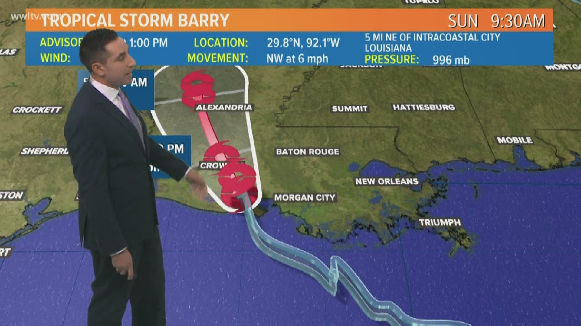
- 3:10 a.m. - WWL-TV Meteorologist Chris Franklin explains more on the National Hurricane Center's most recent update and how the impacts of Tropical Storm Barry on Southeast Louisiana are greatly reduced.
- 2:27 a.m. - WWL-TV Meteorologist Chris Franklin gives the "All Clear" on Tropical Storm Barry in the New Orleans metro area.
"The National Hurricane Center and the National Weather Service have given us the ALL CLEAR! There are no longer ANY tropical watches or warnings!
- A Flash Flood Watch will remain in effect through this evening with potential localized flooding due to rain bands.
- Storm Surge Warnings have been replaced with Coast Flood Advisories through the next high tide cycle.
- We are under a Marginal Risk (1 of 5) for any severe weather. Greatest threat would be from weak/brief tornadoes.
- 2:10 a.m. - The number of outages around the state is slowly climbing as Barry makes its way north, but some parishes affected early Saturday morning have already seen improvements in Southeast Louisiana.
More than 70,000 out of power in Louisiana from the effects of Tropical Storm Barry -- which was briefly Hurricane Barry, the first of the 2019 hurricane season.
Only a portion of those outages, however, were in Southeast Louisiana. Keep Reading
- 1:05 a.m. - The Tropical Storm Warning for Barry has ended for much of Southeast Louisiana, from east of Morgan City to Grand Isle, including Lake Pontchartrain, Lake Maurepas, and metropolitan New Orleans. All Storm Surge Watches have ended. A Storm Surge Warning is still in effect for Lake Pontchartrain.
- 12:51 a.m. - Tropical Storm Barry's winds continue to drop in strength, now to 45 mph as it moves inland toward Alexandria, Louisiana. The storm continues to move at 8 mph with central pressure of 1004, a slight increase from the National Hurricane Center's last update at 10 p.m.
-12:09 a.m. - 69,000 people on Entergy Louisiana's power grid are without electricity across the state. The place with the most outages in Terrebonne Parish (13,500), after taking the brunt of Tropical Storm Barry's hurricane-force winds early Saturday morning.
Saturday, July 13:
-11:36 p.m. - While Tropical Storm Barry was pushing through Louisiana after making landfall Saturday afternoon, the City of New Orleans held a press conference to remind residents that the storm still poses a risk and to ask them to not let their guard down. During it, City Councilman Jay Banks used a metaphor that any New Orleans Saints fan would appreciate, reviving a joke that refuses to die.
"New Orleans, don't choke. Do not be like that team that was in the Super Bowl and thought the game was over, and went home and did not win," he warned, referring to that now-infamous Super Bowl match-up between the Atlanta Falcons and the New England Patriots. Read More
-11:11 p.m. - River flooding on the Northshore in St. Tammany Parish is re-forecast to no longer crest at heights considered "major flood status." Instead, the Tchefuncte River at Covington and at Folsom and the Tangipahoa River at Robert are now projected to reach moderate flood status.
- 10:55 p.m. - As Tropical Storm Barry pushed into Louisiana Saturday, the storm's winds caused problems for thousands of residents - including power outages here in New Orleans.
WWL's Caresse Jackman came across a woman living in Treme off N. Rocheblave Street that was without power and relies on an electric oxygen machine.
Darlene Searls pleaded for help because she and the surrounding area, including Dumaine Street, had been without power for nearly two hours. Read more
- 10:30 p.m. - A viewer records a mesmerizing timelapse of the Tropical Storm Barry's movement from his wharf as it rolled through Fairhope, Alabama.
- 10 p.m. - Flood gates reopening in New Orleans; the goal is to have all gates open by Monday
- 9:40 p.m. - The National Weather Service at 10 p.m. said dangerous storm surge and wind conditions continue across the north-central Gulf Coast. Heavy rains and life-threatening flooding is expected to spread northward across the lower Mississippi Valley.
The Tropical Storm Warning from the Mouth of the Mississippi River to east of Grand Isle has been discontinued.
Watches and warnings in effect:
- A Tropical Storm Warning is in effect for Grand Isle to Cameron; Lake Pontchartrain and Lake Maurepas including metropolitan New Orleans
- A Storm Surge Warning is in effect for Intracoastal City to Biloxi; Lake Pontchartran
Barry is moving toward the north-northwest near 8 mph. A turn toward the north is expected on Sunday, and this general motion should continue through Monday. On the forecast track, the center of Barry will move across central Louisiana tonight, through northern Louisiana on Sunday, and over Arkansas Sunday night and Monday. Maximum sustained winds have decreased to near 50 mph. Barry is forecast to weaken to a depression on Sunday. Tropical-storm-force winds extend outward up to 205 miles mainly over water to the southeast of the center.
- 9:34 p.m. - All RTA services are currently suspended. The RTA anticipates service will be suspended through Sunday and is expected to resume Monday morning weather and road conditions permitting.
- 9:15 p.m. - Louisiana Gov. John Bel Edwards in a news conference gave updates on Tropical Storm Barry. He said:
- This storm has a long way to go before it leaves the state, we still have a significant amount of rain coming
- There are 462 individuals in 27 shelters
- Pay attention to the water, don't let your guard down
- The rainbands extend deep into the gulf and as they are coming to shore, they're producing more rain now than what we saw earlier in the day Saturday.
- "Every storm is different, my concern is we have a lot of people going to bed tonight thinking the worst is behind them and that's not the case."
- NWS said we have flash flooding coming our way, but it could happen anywhere, we can't predict precisely where.
- With the total rainfall predicted overnight, we anticipate flash flooding where life will be threatened
- No word on a reduced storm surge yet on Lake Pontchartrain
- "We've been told in the last 45 minutes that we should not gauge what we see tonight on what we've seen today."
- Watch the full news conference here
- 9 p.m. - Louisiana Gov. John Bel Edwards will give an update on Tropical Storm Barry. Tune in on the live stream at the top of this story.
- 8:50 p.m. - NWS encourages everyone to stay off the road Saturday night as rain continues to fall from Tropical Storm Barry.
- 8:32 p.m. - The NWS says rainfall rates of 2 to 3 inches per hour are possible with a band of very heavy rain extending from New Orleans north through eastern St. Tammany and eastern Washington parishes.
- 8:30 p.m. - Doppler Radar indicates that over 2 inches of rain has fallen in Chalmette from a feeder rainband moving through, and street flooding is likely, says WWL - TV Meteorologist Dave Nussbaum.
- 8:19 p.m. - TORNADO WARNING issued for Orleans and St. Bernard parishes until 8:45 p.m.
- 8:15 p.m. - Tornado warning expired for all parishes.
- 8:10 p.m. - We heard from viewers about streets not draining and concerns about catch basins after Wednesday's flooding in the metro area. So we went out to see for ourselves.
- 8 p.m. - FLASH FLOOD WARNING issued for Orleans, Plaquemines, and St. Bernard parishes until 11 p.m.
- 7:53 p.m. - Tornado warning canceled for Jefferson Parish remains in effect for Plaquemines and St. Bernard parishes.
- 7:50 p.m. - A very heavy rain band is moving north through parts of Orleans, Jefferson, Plaquemines and St. Bernard parishes.
-7:35 p.m. - TORNADO WARNING issued for Orleans, Jefferson, St. Bernard and Plaquemines until 8:15 p.m.
- 7:20 p.m. - Tropical Storm Barry winds decrease down to 60 mph and pressure has risen, according to the National Hurricane Center. Motion is a little faster at 8 mph to the NNW. Convection offshore has also weakened considerably. Some bands of heavy rain are possible, but widespread flooding doesn't look likely.
- 7 p.m. - WWL-TV has switched off our continuous coverage of Tropical Storm Barry, and the station is returning to regularly scheduled programming unless there are unexpected developments with the storm overnight.
- 6:54 p.m. - RTA service will be suspended through Sunday in New Orleans. Service is expected to resume as normal Monday morning.
- 6:40 p.m. - Southeast Louisiana Flood Protection Authority East has announced they will begin working to reopen several key floodgates in St. Bernard and Orleans parishes.
In St. Bernard Parish, the Highway 39, Highway 46 and LA 300 gates, as well as all river gates, will be opened.
In Orleans Parish, the Highway 90 gate and several key river gates along the cruise terminal (Poydras to Felicity) will be opened alongside several rail line gates for CSX, Public Belt and Norfolk Southern.
- 6:34 p.m. - Plaquemines Parish President Kirk Lepine lifted the mandatory evacuation for the Eastbank of the parish Saturday. The order will take effect at 8 p.m. and residents will be allowed back to their homes.
Parish officials warned residents that the floodgate may still be closed when they return, and motorists might have to use the bypass road.
The Belle Chasse /Scarsdale Ferry will begin operations again as well.
- 6:29 p.m. - The New Orleans Museum of Art has announced they will reopen for normal operation Sunday as Tropical Storm Barry begins to weaken after making landfall Saturday morning.
- 6:26 p.m. - Jefferson Parish officials said residents should still expect another six to eight inches of rain from Tropical Storm Barry before it is expected to weaken into a tropical depression Sunday.
The parish's emergency operations center will operate at "partial activation" from 7 p.m. onward before shutting down Sunday at 7 a.m.
- 6:19 p.m. - After the sun goes down Saturday, New Orleans residents should brace for showers throughout the night as the bands from Tropical Storm Barry make their way through the city.
- 6:15 p.m. - Terrebonne Parish officials said they believe tropical storm-force winds will abate around 2 a.m. Sunday morning, as the parish continues to face flooding and stormy conditions.
- 6:03 p.m. -
- 5:54 p.m. - The Coast Guard is set up in Slidell, preparing for potential flooding brought on by Tropical Storm Barry's heavy rainfall.
- 5:44 p.m. - Crews are working to plug up one of the gaps in the flood wall at West Point A La Hache in Plaquemines Parish after water rushed through the hole earlier in the day.
- 5:40 p.m. - Well that's one way to get around in the storm...
- 5:25 p.m. - We've seen plenty of animals fleeing from Tropical Storm Barry, ranging from the cute to the downright creepy.
- 5:20 p.m. - If you have questions about Tropical Storm Barry, you can call our Tracking Barry hotline at 504-529-6450 for answers.
- 5:17 p.m. - Any port in a storm: this mouse is the latest animal we've seen doing whatever it can to stay above the floodwaters as Tropical Storm Barry moves inland.
- 4:59 p.m. - A recommended evacuation has been issued for the Pointe-Aux-Chenes area of Lafourche Parish due to overtopping of the levee in that area.
Impacted residents are encouraged to go to the shelter at the Raceland Recreation Center, located at 241 Recreation Drive.
- 4:39 p.m. - Louisiana State Police arrested a man after a rollover crash on I-10 which led to the discovery of 40 grams of cocaine in his vehicle.
Officials are urging Louisiana residents to avoid the roadways if possible.
- 4:29 p.m. - If there wasn't a tropical storm bearing down on the city, it would be a pleasant day in New Orleans.
- 4:26 p.m. - Tropical Storm Barry continues pushing north through Louisiana as the state prepares for heavier rain brought in by the heavy tail end of the storm.
The latest predictions show the storm will continue moving in a northwestern direction through Saturday before heading directly north on Sunday.
- 4:17 p.m. - Around 3,000 Entergy customers in Orleans Parish are without power. The total number of people without power has dropped to an estimated 71,000 as hundreds of Entergy workers try to bring service back to residents impacted by Tropical Storm Barry.
- 3:55 p.m. - St. Tammany Parish has opened three shelters for people in low-lying areas of the parish that could be flooded as Tropical Storm Barry moves through the area.
The shelters are located at:
- Covington High -73030 lions drive Covington
- Lee road Jr. High - 79131 Highway 40 (Lee Road), Covington
- Pearl River High School 39110 Rebel Lane, Pearl River
- 3:36 p.m. - Anybody looking for information about sheltering should call 211 or text LASHELTER to 898211 for the most current sheltering information.
- 3:26 p.m. - Metairie residents have been left in the dark about when their power would be restored. Entergy says it might be hours - but it might be days.
Ed. Note: Story continues below the video
- 3:15 p.m. - Slidell police have shut down all vehicle traffic going in and out of the Palm Lake subdivision and Camellia Drive.
- 2:55 p.m. -The city of Kenner has declared a state of emergency ahead of heavy rain caused by Tropical Storm Barry.
The city is the latest area to declare a state of emergency, after the state of Louisiana, several parishes and the city of New Orleans declared states of emergency ahead of the storm.
- 2:41 p.m. - The West Closure Complex in Belle Chasse, known as the largest pumping station in the world, will turn on its pumps today at 3:30 p.m. in preparation for Tropical Storm Barry.
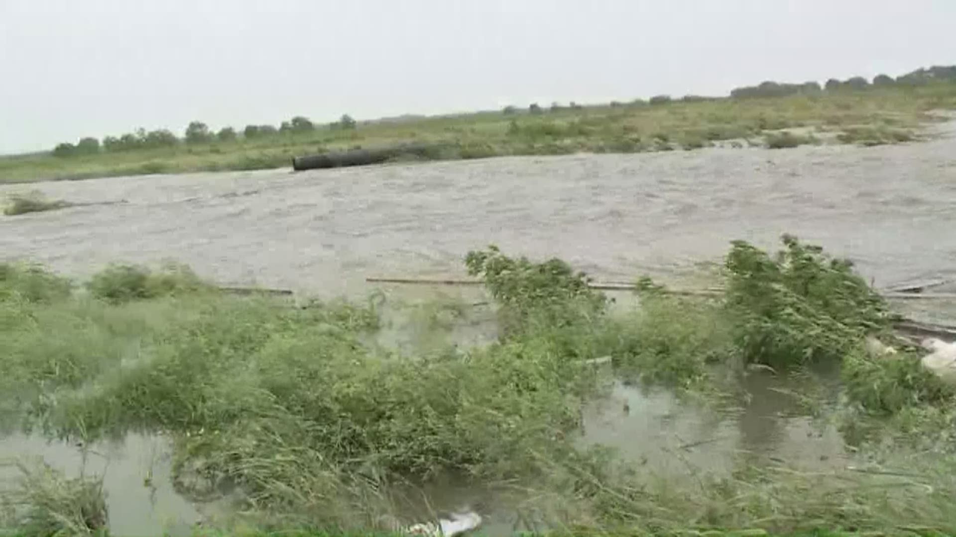
- 2:37 p.m. - The latest from lower Dularge, where a levee overtopping has forced a mandatory evacuation order: the levee has not broken, but water has gotten high enough to climb over the levee wall.
- 2:35 p.m. - According to the mayor of Morgan City, where Tropical Storm Barry made landfall as a hurricane, the entire city has no power.
- 2:25 p.m. - What appears to be two major, gaping holes in a back levee near West Pointe a la Hache are sending water towards Highway 23 in Terrebonne Parish.
While this is not the levee that protects the parish from the Mississippi River, if the road floods, the southern half of the parish will be cut off from the rest of the area by floodwaters.
- 2:16 p.m. - As part of our coverage of Tropical Storm Barry, we're taking you behind the scenes using Facebook Live interviews with the reporters who are on the front lines throughout the state.
Paul Dudley sat down with Jade Cunningham to talk about his 12-hour shift reporting on the storm, the dangers of flooding roads and the kindness of people caught up in the storm.
Ed. Note: Story continues below the video
- 2:07 p.m. - Coast Guard officials warned residents that Tropical Storm Barry would force their search and rescue teams to land as it moves across the state, crippling the response times for first responders if people are trapped by floodwater.
The Coast Guard has 20 crews and aircraft staged in Houston, Texas; Mobile, Alabama and New Orleans prepared to assist in search and rescue operations.
A spokesman for the organization said the late arrival of the storm's major rains would also complicate rescue efforts because heavy rain is likely to fall overnight, when the darkness increases safety concerns for the crews.
- 2:01 p.m. - The latest update from Entergy is that there is no update. Around 74,000 people across the state are without power. Crews remain unable to access electrical equipment because of flooding and high winds, especially through much of southern Louisiana.
- 1:52 p.m. - Mandatory evacuation orders have been issued for parts of Terrebonne Parish.
All areas along LA Highway 315 and Brady Road below or south of Falgout Canal have been ordered to evacuate. This mandatory evacuation is necessary due to the overtopping of the Lower Dularge East Levee.
- 1:36 p.m. - City crews have cleared 60 tons of debris from catch basins throughout New Orleans since Wednesday's storm.
- 1:29 p.m. - For those asking, the levees overtopping in Myrtle Grove are NOT part of the federal levee system.
- 1:20 p.m. - Here's the latest update on Tropical Storm Barry, based on new data from the National Hurricane Center. The WWL-TV meteorology team broke down the new information live on Channel 4:
- 1:13 p.m. - Roads continue to clear out ahead of torrential rain expected from Tropical Storm Barry as it passes through Louisiana.
Residents are prepared for anywhere between six and 20 inches of water in different areas around the state.
- 12:50 p.m. - Barry has weakened back to a tropical storm after making landfall Saturday morning.
Heavy rains are still expected as the storm moves inland.
- 12:30 p.m. - Flood Authority East is urging residents who have parked in front of floodgates to move their cars, because they will begin opening some of the floodgates when officials deem it safe to do so, and cars parked in front of the gates cause public safety issues.
- 12:22 p.m. - The latest from Terrebonne Parish:
- 12:15 p.m. - Hurricane Barry is bringing a slight relief from the summer heat ahead of a deluge of rain.
- 12:05 p.m. - The Archdiocese of New Orleans is excusing Catholics from mass on Sunday because of Hurricane Barry.
- Noon - After making a small amount of progress earlier in the morning, Entergy's outage map confirmed that nearly 75,000 customers were without power throughout the state.
Terrebonne and Lafourche parishes have the most people without power, with 17,000 and 12,000 customers in the dark respectively.
Entergy has mobilized nearly 3,000 workers to troubleshoot issues, but many areas are inaccessible because of floodwater or high winds preventing crews from accessing power equipment.
- 11:57 a.m. - Northshore residents are braving the floodwaters in Mandeville to take a look at the overflowing Lake Pontchartrain.
- 11:44 a.m. - Residents in New Orleans were unhappy with the mayor's decision not to distribute sandbags in the city ahead of Hurricane Barry. But Cantrell said the sand could interfere with the Sewerage & Water Board pumps.
But S&WB had to backtrack after a reporter tweeted a photo of sandbags barricading the front door to their main office.
- 11:38 a.m. - From the city of New Orleans press conference:
- 11:35 a.m. - If you were planning to go to a Breaux Mart to get last-minute groceries, make other plans. The supermarket chain confirmed that all metro New Orleans locations would remain closed Saturday.
They are currently set to reopen Sunday.
- 11:30 a.m. - Well this is horrifying! Cockroaches were spotted in Manchac climbing and swimming to get out of the incoming water from Hurricane Barry.
Ed. Note: Story continues below the video
- 11:17 a.m. - We're not out of the woods yet, Mayor Latoya Cantrell said at a press conference giving an update on Hurricane Barry.
"The primary risk continues to remain heavy rains for the city of New Orleans."
- 11:09 a.m. - Entergy officials have brought power back online for 5,000 people, dropping the number of customers without power throughout the state to 58,000.
Crews are unable to access certain areas due to flooding, and cannot use baskets to reach hanging wires if winds are above 30 mph. Hurricane Barry has brought winds of nearly 70 mph to areas throughout the state.
- 11:06 a.m. -
For everything before 11 a.m. on Saturday, July 12, click here.
The U.S. National Hurricane Center said in its 11 a.m. Saturday advisory that Barry had reached maximum sustained winds of 75 mph, with higher gusts.
Hurricane-force winds were measured some 45 miles to the east of the storm's center, which was located 40 miles south of Lafayette, Louisiana. It was moving northwest at 6 mph.
Weather forecasters said a hurricane warning is in effect for Intracoastal City to Grand Isle. Such a warning means that hurricane conditions are expected within the warning area.
Download the FREE WWL-TV News app now in the iTunes store or on Google Play for tropical weather updates through hurricane season.


