NEW ORLEANS — Severe weather season is upon us and now is as good as ever to brush up on how meteorologists measure how powerful such storms can become.
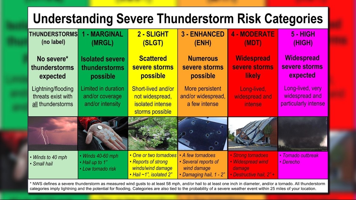
The National Weather Service's Storm Prediction Center is in charge of forecasting the risk of severe weather nationwide, and they issue what's known as "convective outlooks" each day. Although you might have never heard of the name of these forecasts, you've likely heard of the categories.
They include:
- Marginal risk
- Slight risk
- Enhanced risk
- Moderate risk
- High risk
A severe thunderstorm is defined as a storm that produces one or more of the following: a tornado, winds of 58 mph or greater and 1-inch diameter hail or larger.


But what about those risks? What's the difference from a "marginal" risk from a level just a step up?
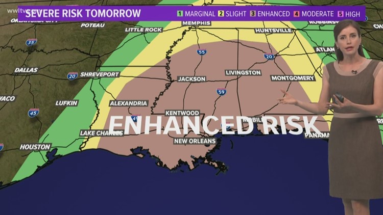
When you look at a TV map or one produced by the Storm Prediction Center, see if your area is outlined by one of these risks. If you happen to be in an area, know there is the potential for severe weather within 25 miles of your location.
All of them are based on probability, meaning the higher the risk, the greater the probability -- which is not always a guarantee -- of severe weather
A marginal risk means isolated severe storms are possible, with the threat of isolated damaging winds, small hail and maybe a tornado. A slight risk ramps up the probability, with more storm reports. The enhanced risk notes more numerous or widespread severe storms -- some of those can be intense.
Moderate and high risks are issued less infrequently as these are reserved for the most intense severe-weather events. Expect long-lived storms, including a tornado outbreak or a derecho, a line of thunderstorms with destructive winds.
Let these categories be your guide. Stick with Your Local Weather Experts meteorologists Dave Nussbaum, Alexandra Cranford and Chris Franklin on what to expect each day across Southeast Louisiana.


