

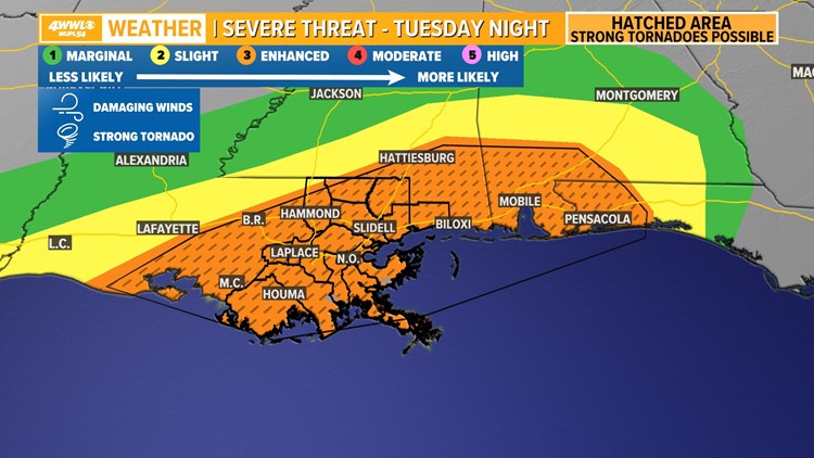
NEW ORLEANS — Severe thunderstorms are expected to hit southeast Louisiana and the New Orleans metro area on Tuesday evening, bringing the risk of potentially damaging winds and tornadoes, a few that could be strong.
A line of strong storms is expected to charge through the area in the evening, around 9 p.m. with the worst of the weather expected between 10 p.m. and 2 a.m.
The exact timings of these storms can change, so residents should check back for updates as we get closer to Tuesday night.
The storms are due to a potent area of low pressure digging into south Texas which is forecast to swing northeast over Louisiana and the Gulf Coast ahead of a cold front.
Rain totals look like a half-inch to possible 1-2 inches in spots. Rain will be mainly gone by early Wednesday morning.
Before a tornado strikes, it is important to create a plan for your family. NOAA recommends that the plan includes an emergency meeting place and shelter places. Pick a safe room in your home on the lowest level and away from windows to go to in case a tornado warning is issued in your area.
► Get breaking news from your neighborhood delivered directly to you by downloading the new FREE WWL-TV News app now in the IOS App Store or Google Play.