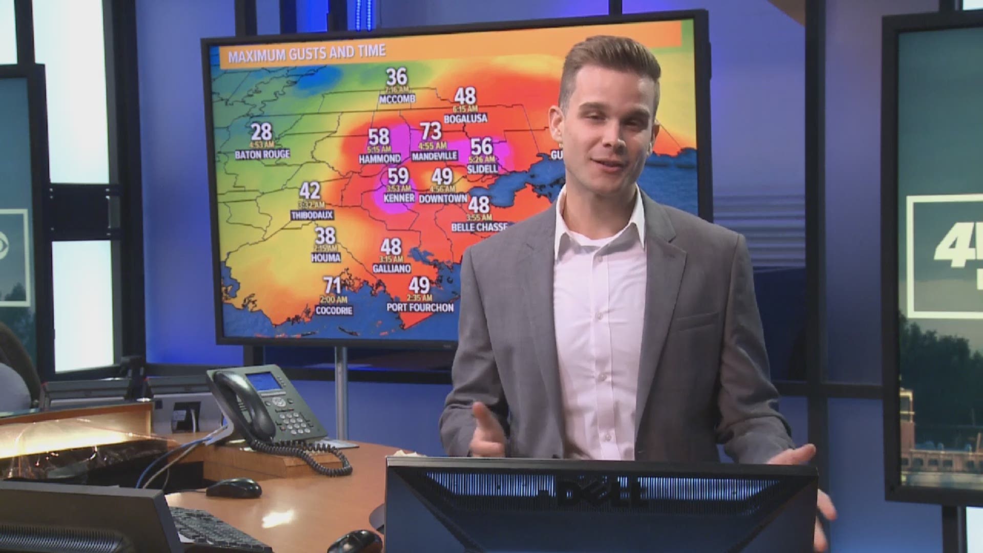
NEW ORLEANS — Multiple systems played a role in the forecast for Southeast Louisiana early Saturday morning. Olga began as a unique tropical depression forming very close to a cold front. The storm became a depression on Friday morning before strengthening into a tropical storm by Friday afternoon. At this time the main impacts were expected to be heavy rain with gusty winds.
By Friday night Olga began its transition into a post-tropical system. According to the National Hurricane Center the cold front disrupted the storm and it was no longer tropical in nature.
Even though the system wasn't considered tropical, the forecast didn't change. We still expected heavy rainfall through early Saturday morning with gusty winds.
The National Weather Service and Your Local Weather Experts forecast winds around 20-25 mph with higher gust. The 7 PM Friday advisory from the National Hurricane Center only gave the New Orleans metro around a 20% chance of seeing tropical-storm-force winds of 39 mph or greater. Of course, these numbers were too low as the area saw widespread gusts over 50 mph.
By early Saturday morning, the remnants of Olga's low moved onshore in Terrebonne Parish. The heavy rain associated with the system began to intensify and rainfall became extremely heavy.
These strong storms near the center of the system continued as it moved toward the New Orleans metro and Northshore. This could have played a role in the higher winds. Heavy rain can help bring high winds to the surface that start a couple of thousand feet off the ground.
As the heavy rain moved in the winds picked up dramatically. Another issue was the ground was already becoming saturated from the heavy rainfall. When the ground is saturated trees can fall more easily.
Overall, there are still many questions about Olga that that will be studied in the future, so meteorologist can better forecast similar situations. This forecast was a very unique situation and this is going to provide an excellent case study.

