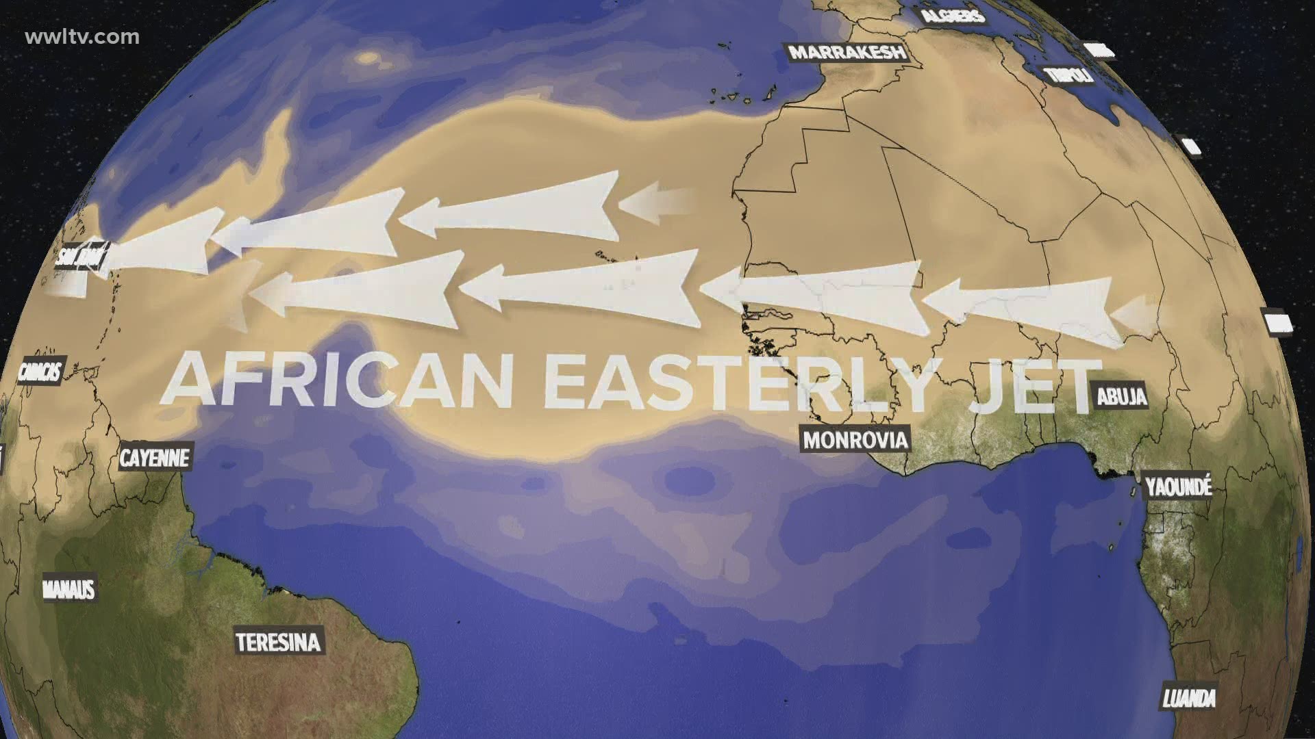
NEW ORLEANS — A massive plume of dust from the Sahara Desert is blowing across the Atlantic and arrived in the New Orleans area Friday.
This is a common thing that happens in the early summer, as trade winds from the east transport dry, dusty air from the Sahara Desert directly over the ocean.
But this year, it is remarkable – stretching nearly 5000 miles, the dust plume will reach the Gulf Coast and maybe even the mid-Atlantic Friday and this weekend.
Why is there so much dust this year? It appears an especially active pattern of strong winds called the African easterly jet is sending more than usual our way. The pattern usually slows down by August.
Saharan dust typically does a few things to our weather.
- It makes it hard for hurricanes to form, since it deprives them of the warm, humid air they use for fuel.
- It dries out our atmosphere, so we get less rain.
- The daytime sky can look pale and hazy.
- Sunsets look glorious as sun rays shine around the dust particles.
Usually, the dust stays high in the atmosphere. But this year it’s so thick, the dust is showing up at the surface too – collecting on cars and causing low air quality and visibility (like it has in Hispaniola and Puerto Rico this week).
Biologists think it could even contribute to algae blooms because of chemicals that settle over the Gulf of Mexico.
For us, it mainly means we’ll have a drier, hazy forecast Friday through Monday. But there are more swaths of dusty desert air blowing over the ocean now, which could deliver more to us in the next couple of weeks.
► Get breaking news from your neighborhood delivered directly to you by downloading the new FREE WWL-TV News app now in the IOS App Store or Google Play.

