A Flash Flood Warning Emergency has been issued for parts of the New Orleans Metro until 2:00PM. Street flooding is happening or about to happen. Don't drive through flooded roads.
Severe Thunderstorm Warning including New Orleans LA, Metairie LA and Kenner LA until 11:45 AM CDT. This destructive storm will contain wind gusts to 80 MPH!
A Flash Flood Warning has been issued for parts of St. Tammany until Noon. Street flooding is happening or about to happen.
Flash Flood Warning for parts of St. Tammany, including Slidell LA until 12:30 PM
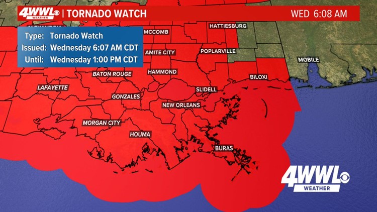
A Tornado Watch is in effect for all of southern Louisiana until 1 p.m. as a strong line of storms moves through the area.
Neutral ground parking is allowed until 8 p.m.
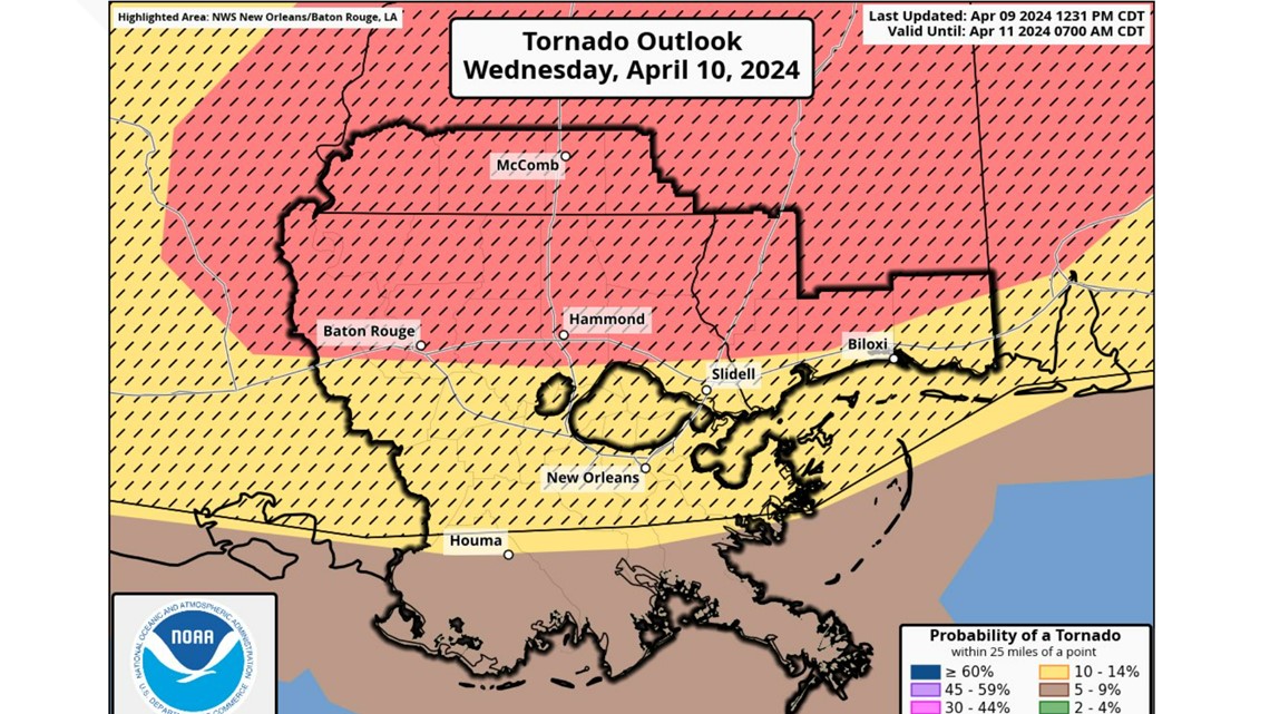
It isn't often that the metro New Orleans area is under an enhanced level (Level 3 of 5) risk for severe weather and tornadoes. It's even rarer to have the Northshore at a level 4 out of 5 (moderate).
Those are the threat levels in the area for Wednesday morning and early afternoon.
When will the storms hit the area?
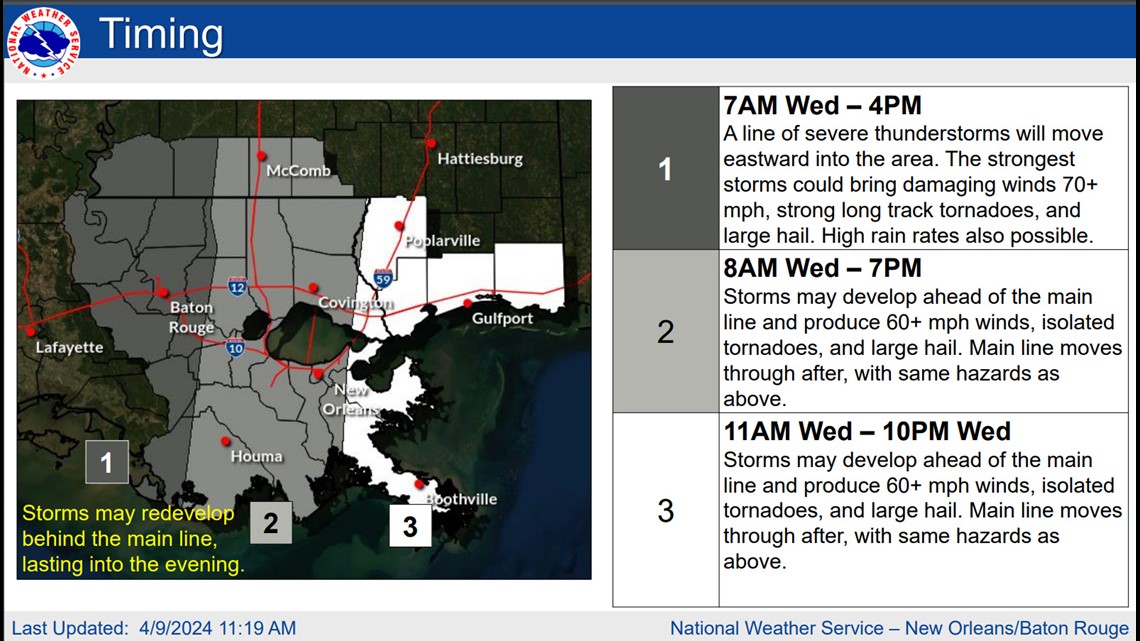
From 6 to 11 am, we'll see mainly scattered to numerous storms. And while they could become severe, the "ingredients" necessary won't be present until closer to noon. And it's from around 11 am to 2 or 3 pm when a line or complex of storms will move quickly across south LA, and MS


What do 'enhanced' and 'moderate' risks mean?
The metro New Orleans area, along with areas east, west and south are mostly under an 'enhanced' risk of severe weather and tornadoes. The National Weather Service defines an 'enhanced risk' as: An area of greater (relative to Slight risk) severe storm coverage with varying levels of intensity.
Parts of the Northshore are under a "moderate" risk for severe weather and tornadoes. While "enhanced" might sound more ominous than moderate, moderate is actually a greater risk. Here is what the National Weather Service's Storm Prediction Center says a 'moderate risk' entails: An area where widespread severe weather with several tornadoes and/or numerous severe thunderstorms is likely, some of which should be intense. This risk is usually reserved for days with several supercells producing intense tornadoes and/or very large hail, or an intense squall line with widespread damaging winds.
Story continues below image


WWL Meteorologist Payton Malone explains the tornado outlook this way: Weather prediction = probability. You can think of these severe weather outlooks in percentages. For example, for areas in red, there is a 15% chance of a tornado within 25 miles of you. That seems low but often that chance is more like 1% or 2%. Take tomorrow seriously.


