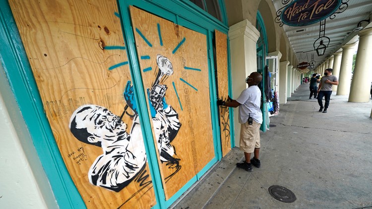
NEW ORLEANS — Tropical Storm Marco is approaching Louisiana for an expected landfall Monday afternoon.
Marco was a hurricane most of Sunday, but the National Hurricane Center (NHC) says its maximum sustained winds decreased after nightfall due to strong wind shear. The NHC cautions that Marco could still cause life-threatening storm surges and dangerous winds along the Gulf Coast.
Here are the effects that southeast Louisiana and Coastal Mississippi can expect as Tropical Storm Marco makes landfall:
⚠️ Tropical Storm Marco Time Line:
Here is a tentative timeline for what to expect from Marco from Monday morning through Tuesday morning:
10 AM Monday - Rain squalls developing from east pushing west. Becoming increasingly more windy.
12 PM Monday - Tropical-storm-force winds spread inland closer to New Orleans. Passing showers and downpours. Storm surge rises along the coast.
2 PM Monday – Center of Marco approaches and skirts the south Louisiana coast as it turns west or possibly makes landfall along the southeast Louisiana coast near Grand Isle. Tropical-storm-force winds near the center, but continued weakening. Rain could be heavy at times. Tides remain high along coast and lakes.
8 PM Monday – Marco’s center continues moving to the west or northwest, likely staying southwest of New Orleans. Breezy winds. Passing showers and downpours. Tides steady or begin to fall slightly.
2 AM Tuesday – Marco’s center is farther west near Houma. Winds weaken. Passing showers and downpours. Tides falls gradually, but remain elevated.
8 AM Tuesday - Winds ease, but still breezy. Cloudy with passing showers and downpours. Rain could be heavy at times. Storm surge falls gradually.
4 PM Tuesday - Marco near TX/LA border. A little breezy in New Orleans. Cloudy with more passing showers and downpours. Storm surge is still slowly falling.
► Track the tropics with live updates delivered directly to your phone. Text APP to 504-529-4444 to download the FREE WWL-TV News app now or find us in the IOS App Store or Google Play.
⚠️ Marco Impacts:
Here is a look at tentative impacts from Marco by parish. Most of these impacts will be felt from Monday morning through Monday night.
Lafourche, Terrebonne, lower Plaquemines, lower Jefferson, eastern St. Bernard, Hancock County, MS:
Tropical Storm Warning
Storm Surge Warning
• Wind: 30-40 mph, Gusts to 60+ mph - Power outages expected
• Storm Surge: 2-4 feet
• Rainfall: 2-6"+, Flash Flood Watch in effect
• Tornadoes/Waterspouts: A few possible
Orleans, upper Jefferson, upper Plaquemines, western St. Bernard, St. Charles, St. James, St. John:
Tropical Storm Warning
Storm Surge Warning
• Wind: 20-30 mph, Gusts to 40+ mph - Power outages possible
• Storm Surge: 2-4 feet above ground level outside the hurricane protection levee system
• Rainfall: 2-6"+, Flash Flood Watch in effect
• Tornadoes/Waterspouts: A few possible
St. Tammany, southern Tangipahoa:
Tropical Storm Warning
Storm Surge Watch
• Wind: 15-25 mph, Gusts to 30+ mph - Power outages possible
• Storm Surge: 2-4 feet above ground level
• Rainfall: 1-4"+
• Tornadoes/Waterspouts: A few possible
Washington, northern Tangipahoa, Pearl River County, MS:
Tropical Storm Watch
Storm Surge Watch
• Wind: 10-25 mph, Gusts to 30+ mph - Power outages possible
• Rainfall: 1-3"+
• Tornadoes/Waterspouts: A few possible
► Track the tropics, live updates from Your Local Weather Experts delivered directly to you throughout hurricane season by downloading the FREE WWL-TV News app now in the IOS App Store or Google Play.


