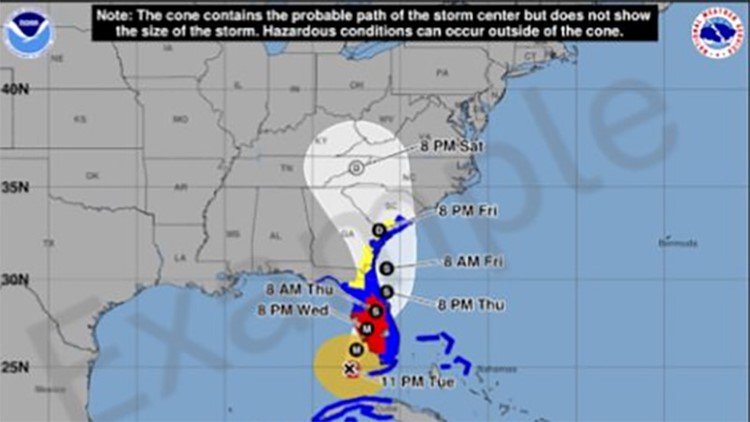
NEW ORLEANS — Even though we're still several months away from the official start of hurricane season, some changes are coming this year that will help people better prepare! The National Hurricane Center is launching a new experimental cone graphic that will show wind impacts for inland areas across the United States.
The new experimental cone graphic will include hurricane and tropical storm watches and warnings for inland areas across the continental United States. Previously, the cone graphic just displayed watches and warnings right along the coastline. Now, it will include the cone plus watches and warnings for all inland areas that are affected by a storm. The National Hurricane Center is making this change so people can understand their risk of strong winds when a storm is on the way.
This new experimental cone graphic is especially important for strong hurricanes, which often bring wind impacts far inland. The ultimate goal of this new graphic is to let the public know their potential wind hazard risk that extends beyond the cone so they can better prepare for impacts.
The regular operational cone graphic (the normal one we see every season) is not going away and will still look the same, (aside from any annual small adjustments that are made to create better forecasts). The normal cone we see every season will still be available at the same times and this new graphic is not intended to replace it. Rather, the new experimental graphic will be a whole new graphic and should be launched around August 15th, 2024. Once it is released in its experimental phase in August, there will be an opportunity for feedback which will help improve it before its final release in the future.
If you'd like more information about the new graphic click here: https://www.nhc.noaa.gov/pdf/NHC_Cone_Graphic_Change_Announcement.pdf


