
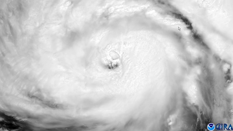
NEW ORLEANS — The National Weather Service in New Orleans has issued a rare "extreme wind warning" large portions of southeast Louisiana as Hurricane Ida pushes inland.
The extreme wind warning is in effect until 6:30 p.m. for parts of St. John the Baptist, St. James, St. Charles, Terrebonne, Lafourche and Jefferson parishes.
At 4:22 p.m., NWS Doppler Radar showed extreme winds, associated with the eyewall of Ida, moving north at 10 mph. WIdespread destructive winds of 115 to 125 mph will spread across the warning area, producing swaths of tornado-like damage.
"THIS IS AN EXTREMELY DANGEROUS AND LIFE-THREATENING SITUATION!" the NWS added.
The NWS says residents should treat these winds as if a tornado was approaching and immediately move to the safe room in their shelter.
"Take action now and protect your life!" the NWS said.
The safest place to be during a major landfalling hurricane is in a reinforced interior room away from windows. Get under a table or other piece of sturdy furniture. Use mattresses, blankets, or pillows to cover your head and body. Remain in place through the passage of these life-threatening conditions.
► Get breaking news from your neighborhood delivered directly to you by downloading the new FREE WWL-TV News app now in the IOS App Store or Google Play.