
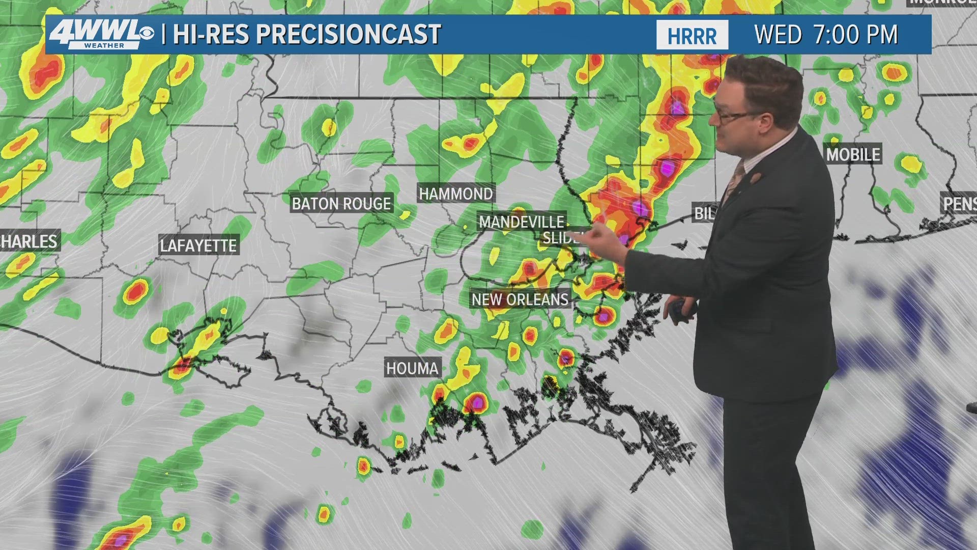
NEW ORLEANS — A Flash Flood Warning continues for parts of southeast Louisiana and Mississippi on Wednesday evening.
Shortly after 7 p.m., a Flash Flood Warning was extended for portions on the Northshore until 8:45 p.m.
Communities that could be affected including Hammond, Bogalusa, Franklinton and the surrounding areas.
Shortly before that, a FFW was issued for parts of Tangipahoa, Livingston, St. John The Baptist, St. Tammany until 10:15 p.m.
Initial warnings issued at 12:30 p.m. were for St. Tammany, Tangipahoa and Washington parishes until 3:30 p.m. on Wednesday.
Pearl River and Walthall counties in Mississippi are also on alert.
Shortly after 1 p.m., a Flash Flood Warning was issued for parts of St. John, Lafourche, St. James, Terrebonne and Assumption parishes until 4 p.m.
Warnings were issued at 3:55 p.m. for Orleans, Jefferson, St. Bernard and Plaquemines parishes.
According to WWL Louisiana meteorologist Alexa Trischler, the Northshore has the highest chance to see flooding, but the Southshore isn't out of the woods. If the line advances enough into the city then heavy rain could also be an issue across the Southshore.
Areas affected could pick up 3-6 inches of rain with isolated spots topping 8 inches.
There is also a low end threat for severe t-storms including gusty winds and isolated tornadoes.
By Wednesday night into Thursday morning the heaviest rain will start to transition to the Southshore. We'll once again watch for heavy rain and street flooding Thursday.
This is a developing story and will be updated.
Stay tuned to WWL Louisiana and logged on to wwltv.com for further updates.