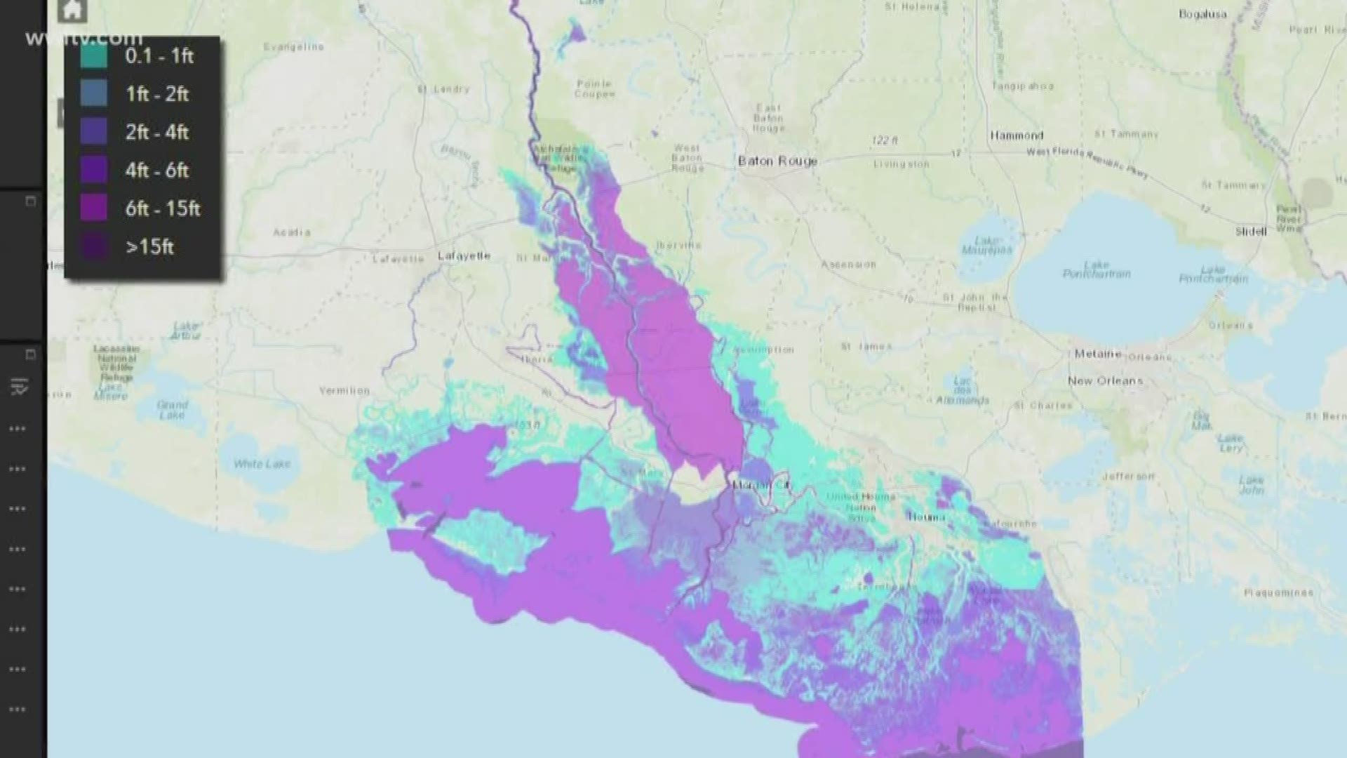
NEW ORLEANS — This Sunday, the Army Corps of Engineers will open the Morganza Spillway for the third time in history. We have an idea of what happens once it opens, but to see water level predictions, the U.S. Army Corps of Engineers released an interactive map.
If you click this link, you'll find "layers."
The first two layers are what you'd see if they didn't open the Morganza or didn't sink the Bayou Chene barge. That is just for comparison.
If you click the third option, that's what they predict you'll see on June 3, the day after the Morganza opens. That map shows mostly what the water levels are right now. The only major difference you're going to see is right at the opening of the Morganza as the water starts to spill into the flood-way.
Every few days you can see more and more water spilling out of Morganza. By June 11, the water is predicted to start contributing to the Atchafalaya Basin where water already is right now. That's when you'll start to see water levels rise slightly in the basin.
The map shows predictions through June 26. The purple shade shows the flood-way and basin will mostly see a range from 6-to-15 feet of water.
If everything stays constant, we're looking at operation of Morganza for 20 to 25 days, however the U.S. Army Corps of Engineer warns rain is still coming down north of us and that could prevent the water from lowering.
So what is going to be under water? In the flood-way itself, it's oil and gas wells and lots of farm land. People living near the flood-way could start seeing more animals like bears and snakes showing up as the water forces them out.
While the map is a good reference, the corps believes it's important people listen to local officials and make sure you understand how this could affect you.

