
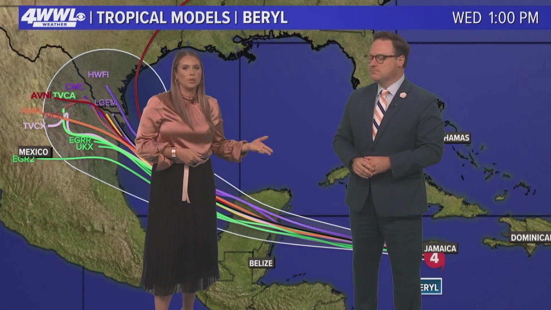
NEW ORLEANS — A quick ‘Models 101’: Weather forecast models are spit out by supercomputers operated by different weather agencies. They run thousands of equations on different layers of the atmosphere, taking factors and data from space and on the ground into consideration. The different formulas sometimes result in different forecasts.
So we had some questions for WWL Louisiana Chief Meteorologist Chris Franklin.
Devin: Hey Chris! Why do meteorologists rely on models instead of creating their own prediction track?
Chris: Well, in a sense we do. The proper way to use models is for guidance to help a meteorologist create their own forecast. The official NHC forecast is made with a consensus of the models as well as their own expertise and experience. And the NHC forecast outperforms the individual models every time.
Devin: We hear a lot about the GFS - run by NOAA - and the Euro, which is run by a governmental agency in Europe. Why are those the two we talk about most often?
Chris: These are the best performing “global” models, meaning they forecast with a large set of data. They provide a broader look at the possible track of a storm, but they aren’t great with small details such as strength. We use “nested” models for that. They only focus on the individual invest or named storm.
Devin: Let’s look specifically at how these two storms predicted the path of Hurricane Beryl. Sometimes the models can be so different from one another. When you’re looking at a hurricane track, how do you choose which model to trust?
Chris: While it’s true, the Euro has a history of performing better with tropical development and tracks, it doesn’t always. There have been times when the GFS was superior. We start by looking at the short term, which model has been doing better. Also, which model is more consistent? For Beryl, the Euro always indicated a track nearly due west across the Caribbean. The GFS has swung from the Caribbean to the Gulf, the Bahamas, then back to the Caribbean. But that doesn’t mean the GFS will be as inconsistent for other storms.
► Get breaking news from your neighborhood delivered directly to you by downloading the new FREE WWL-TV News app now in the IOS App Store or Google Play.