
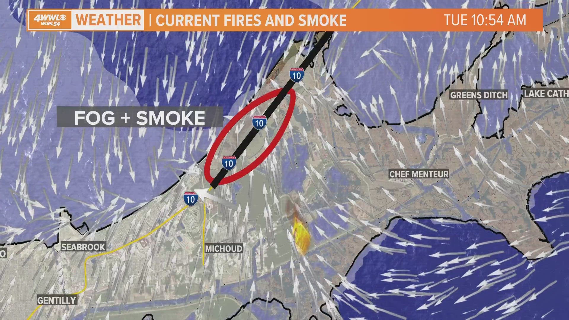
The patchy nature of fog Tuesday morning is partly due to smoke plumes that were blown from marsh fires in New Orleans East.
Fog that forms in patches can be more dangerous than widespread fog because drivers may be able to see fine just before they hit a pocket of fog through which they can barely see at all. This may cause drivers to slam on the brakes or hurtle into other cars as expected in a deadly multi-vehicle crash on Interstate 10.
Smoke enhances fog formation by providing many more particles in the air on which water vapor can condense. That leads to denser fog.
Tuesday early morning winds were calm in most spots around the area. That allowed smoke plumes from the wildfires in New Orleans East to stay almost stagnant and contribute to fog formation where those plumes settled.
In general this week smoke from the wildfires has been blowing northward thanks to light south winds. Later Tuesday morning observations at the Lakefront and Slidell showed a small area where winds were blowing from the north. When the smoke moving northward hit those opposing winds, smoke likely became more concentrated in that particular area in New Orleans East. Factors like these can create isolated spots where visibility can be especially low.
Patchy dense fog can also form near other small-scale influences like bridges, overpasses and near ponds and other bodies of water.
► Get breaking news from your neighborhood delivered directly to you by downloading the new FREE WWL-TV News app now in the IOS App Store or Google Play.