
NEW ORLEANS -- One area of storms has moved east of New Orleans, but get ready for more rain Tuesday through tonight.
We will be warm and humid today as southerly winds pump in moisture from the Gulf. This will help set off scattered showers during the day with mostly cloudy skies. Highs will be in the lower 80s.
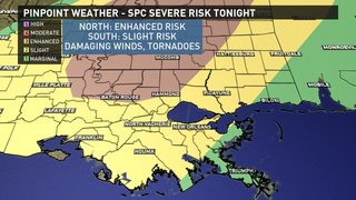
Tuesday night, a stronger cold front will move through with showers and storms ahead and along the front. Any of these storms could be strong to severe. SPC has most of the area under a Slight risk, but part of the Northshore to Baton Rouge are under an Enhanced Risk.
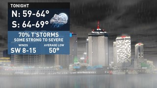
The main threats will be damaging winds and a few tornadoes. The greatest area that will see any severe weather will be over much of Mississippi as the best instability will be located there. However, we will still more unstable than we were Monday Night, so the threat for severe weather is greater. Lows Tuesday night will be in the 60s.
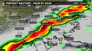
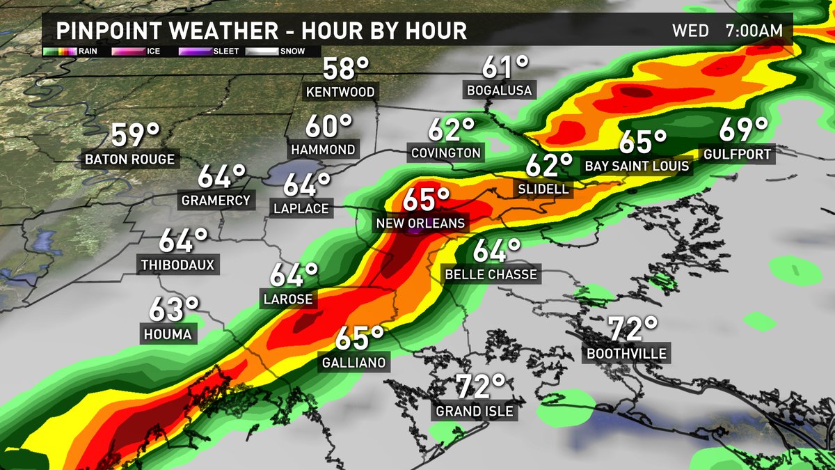
The line of storms will move through mid-morning on Wednesday. Again, some of the storms could be strong to severe. Then we will become clear on Wednesday Afternoon with MUCH Cooler temperatures in the 60s. Wednesday Night will be clear and cold with lows in the 30s north with some frost, and 40s south.
High pressure will build in briefly Thursday and Friday with plenty of sunshine each day. Highs will be in the 60s. Lows will be in the 30s north with some frost and 40s south.
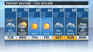
Our weather will go downhill this weekend as an area of low pressure forms over the Western Gulf and moves slowly NE. This will spread scattered showers over the New Orleans area all weekend with highs in the 60s.