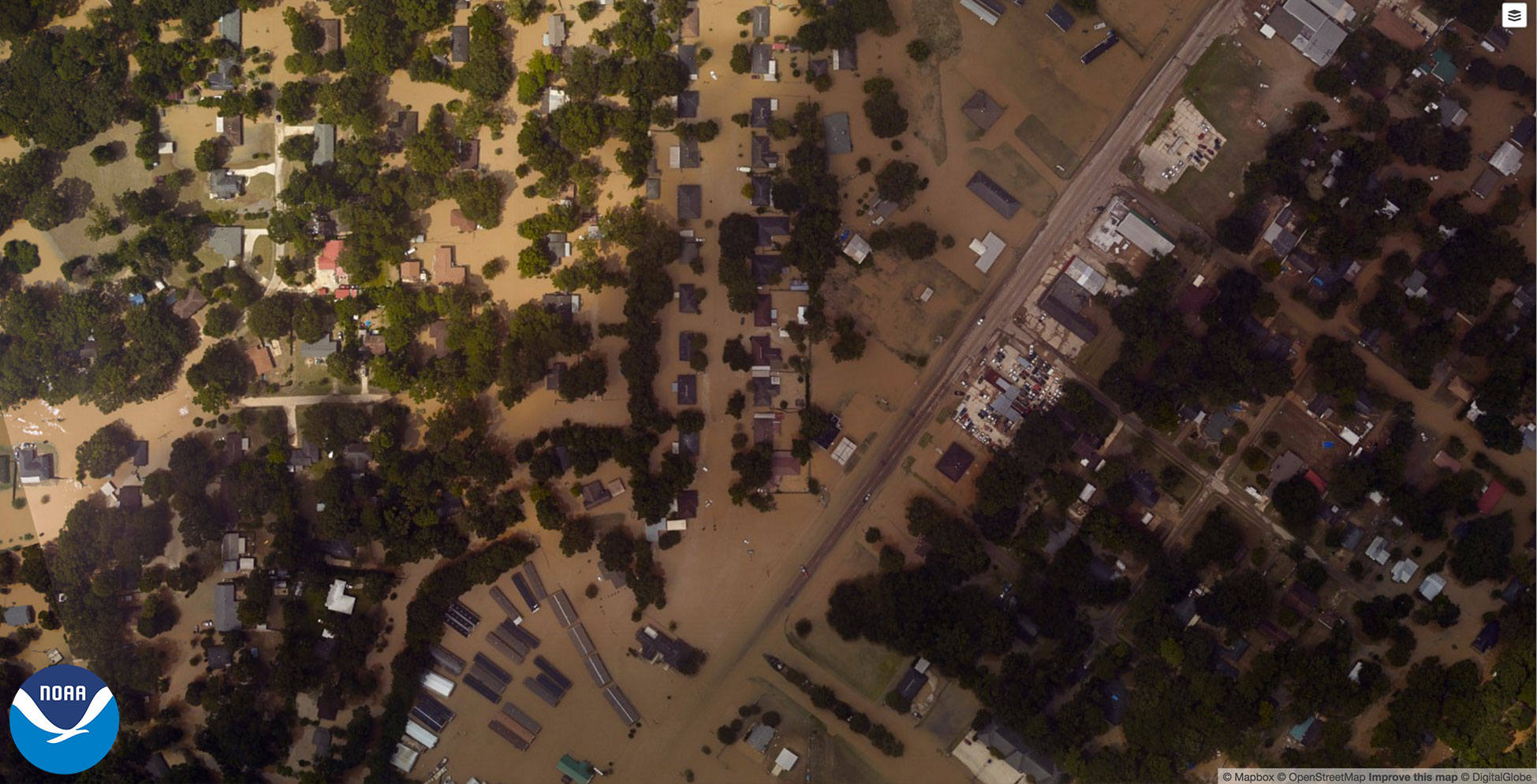
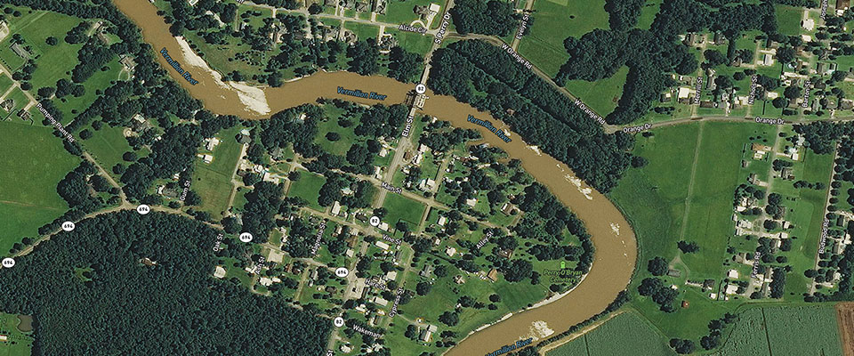
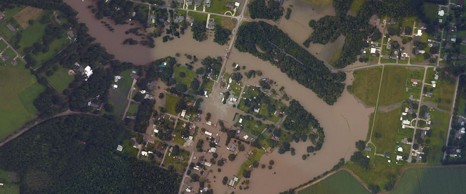
SOUTH LOUISIANA -- Newly released images from the National Geodetic Survey helps assess the damage after recent flooding in southern Louisiana.
Starting August 14, NGS began collecting aerial images in specific areas that were identified by FEMA and National Weather Service.
The before images were provided by Mapbox, Digital Globe and OpenStreetMap.
Here are a few of the images they collected.
Having trouble? See photos from Abbeville, Denham Springs and Port Vincent here.
Abbeville, Louisiana | Download
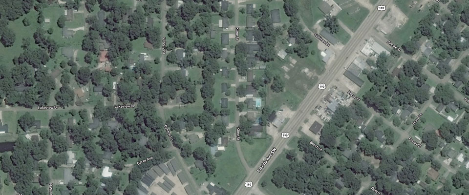
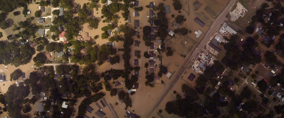
Denham Springs, Louisiana | Download
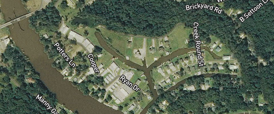
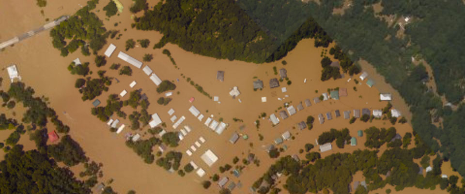
Port Vincent, Louisiana | Download
Here is a description of the photography process from NGS:
A team of NOAA aviators are capturing the images using specialized remote-sensing cameras aboard NOAA's King Air aircraft flying above the area at an altitude between 2000-3000 feet.
NOAA's aerial imagery aids safe navigation and captures damage to coastal areas caused by a storm. Aerial imagery is a crucial tool to determine the extent of the damage inflicted by flooding, and to compare baseline coastal areas to assess the damage to major ports and waterways, coastlines, critical infrastructure, and coastal communities. This imagery provides a cost-effective way to better understand the damage sustained to both property and the environment.

