
NEW ORLEANS — A team of meteorologists from the National Weather Service fanned out across the city to determine exactly what hit New Orleans early Wednesday morning.
They set out to learn whether a tornado or straight-line winds caused a wide swath of damage across the city.
“I will take some pictures," NSW Warning Coordination Meteorologist Lauren Nash said. “I will look at what I see. I will look at some of the construction. Look at the tree damage and then I’ll follow the damage across the city to the east.”
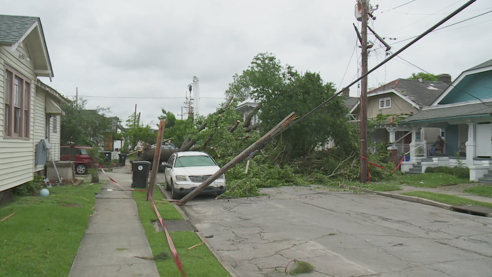
People who live near Pine and Spruce Streets in the Carrollton neighborhood, one of the hardest-hit areas, said the overnight storm that woke them up was not your average line of thundershowers.

“It was louder than any storm I have ever heard,” Wally Darling said. “At one point last night, I was like that might be a tornado. It was just a little louder than I was expecting.”
“I woke up around 1:30 because of the lightning strikes and thunder,” Austin Bagdady said. “Then it was a very concentrated about a two-minute time period where it did sound like a tornado could have touched down.”
Nash and her team surveyed the damage across the city.
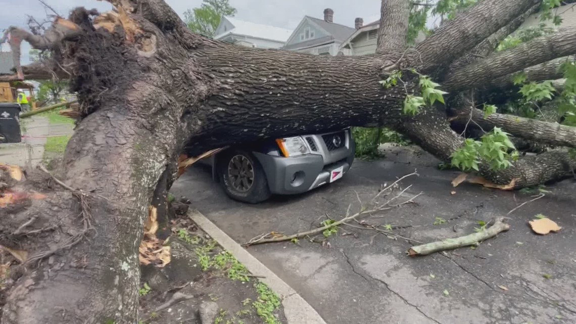
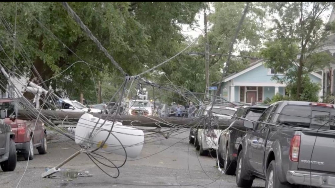
Officials said about three-dozen homes received minor to moderate damage.
The storm was also strong enough to blow covers off some barges docked near Bollinger Shipyards in Algiers.
The wind pattern, the extent of downed trees and powerlines and twisted metal on the ground added up to an EF0 tornado.
It had maximum winds of 85 miles per hour and tracked about five miles through the city.
"This tornado touched down around 2:05 a.m., somewhere between Claiborne Avenue and Carrollton Avenue in the Uptown area,” Nash said. “It tracked east producing mostly tree damage before arriving near the Amtrak terminal and peeling back a tin roof on one of their large buildings.”
From there the storm moved southeast causing damage in the Central Business District.

Eventually, it crossed the Mississippi River and hit Algiers.
According to the National Weather Service, the storm spun up quickly and it may have formed before they had a chance to put out a tornado warning.
“In really, really short quick tornadoes, they can spin up in 30 seconds to a minute to two minutes,” Nash said. “It makes it very difficult to catch on radar.”
The weather service said the fact the tornado hit in the early morning hours, when most people were in their homes and not on the street, may be why there were no injuries during the storm.